Finding a continuous 143-acre tract of land for under $150,000 is an increasingly rare occurrence in today’s real estate market Located along Left Fork Toler Creek Road near Harold in Floyd County, Kentucky, 1083 Left Fork Toler Crk presents 143 acres of unimproved mountain acreage offered at an asking price of $139,000.
Following two price adjustments since its initial April 2026 listing—first from $159,000 down to $149,000, and most recently a $10,000 reduction on August 6, 2026, bringing the price to $139,000—this listing represents a baseline land valuation of approximately $972 per acre.
The property offers a dual-utility land package: a front lot positioned directly along the main road with public water available for building a home, paired with over 140 acres of secluded, timbered mountain terrain suitable for private hunting, off-grid cabin retreats, or long-term land banking.
However, buying large-format rural acreage at a sub-$1,000 per acre price point requires a grounded evaluation. Purchasing unimproved mountain land involves evaluating steep topography, verifying property boundaries, estimating utility extension costs, assessing septic suitability, and understanding property tax mechanics. This article provides an objective, deep-dive real estate analysis of 1083 Left Fork Toler Crk, examining its financial metrics, land footprint, utility assets, development potential, buyer profiles, and essential due diligence steps.
Property Overview and Core Specifications
Establishing official listing disclosures, county records, and physical parameters provides the analytical foundation for evaluating this property.
- Property Address:1083 Left Fork Toler Crk, Harold, Kentucky 41635
- County:Floyd County
- Current Asking Price:$139,000 (Reduced from $159,000)
- Land Footprint:143.0 Acres (approximately 6,229,080 square feet)
- Price Per Acre:Approximately $972.03 per acre
- Parcel Identification Number:108000010700_2
- Property Type:Residential / Unimproved Mountain Land
- Residential Structure:None (0 Bedrooms, 0 Bathrooms)
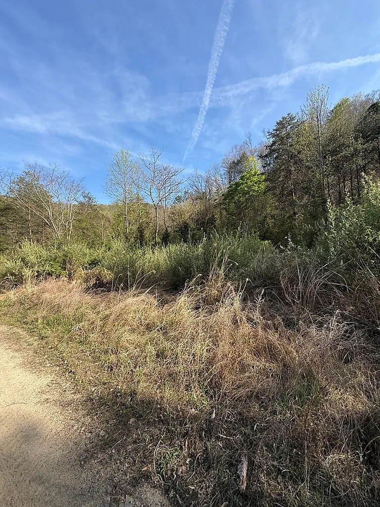
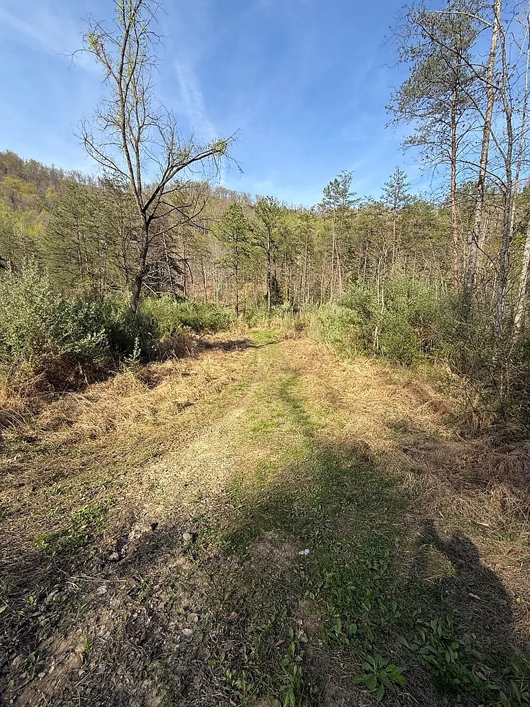
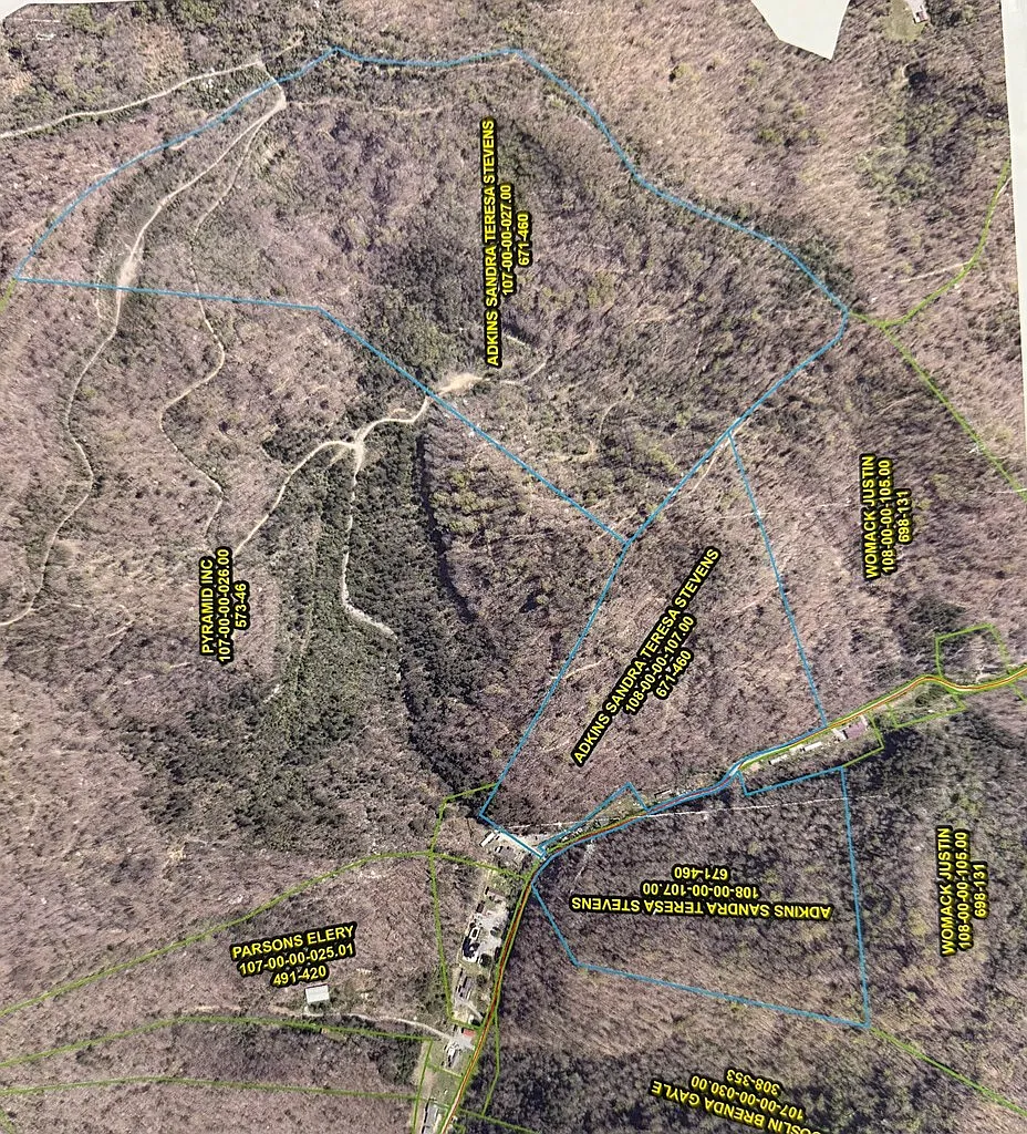
- Topography:Valley road frontage lot transitioning into steep timbered hillside acreage
- Public Water Access:Public water service available along the main road
- Wastewater Disposal:Private septic system required (No active municipal sewer)
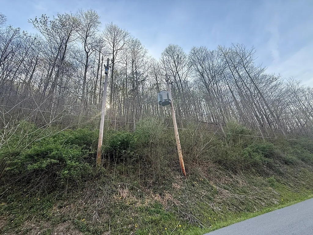
- Electrical Utilities:Electrical utility service available along road frontage
- Zoning Restrictions:None reported (Unrestricted rural land)
- County Tax Assessed Value:$29,000
- Annual Property Taxes:$349 per year
- MLS Identification:Eastern Kentucky Association of Realtors (MLS #128471)
- Initial Date on Market:April 9, 2026
The Numbers and Price Analysis
Evaluating unimproved mountain acreage requires separating raw land value from site improvement costs. On large rural land tracts, the primary metric is the cost per acre combined with road access and utility availability.
At an asking price of $139,000 for 143 acres, the mathematical baseline breaks down as follows:
- $139,000 ÷ 143 acres = $972.03 per acre
In the Eastern Kentucky real estate market—specifically across the Cumberland Plateau and Appalachian coalfield region of Floyd, Pike, and Knott counties—raw rural land tracts between 50 and 200 acres typically trade between $1,200 and $2,800 per acre. A purchase price of $972 per acre sits below regional averages.
A sub-$1,000 per acre price point reflects three primary physical factors:
- The property consists predominantly of steep hillside mountain terrain, which limits dense suburban-style residential development.
- The parcel requires site preparation, driveway grading, and septic installation before residential occupancy is possible.
- The listing notes that the buyer must verify exact acreage boundaries and property lines through an independent survey.
For a buyer seeking scale, total privacy, or a personal hunting domain, acquiring 143 contiguous acres for $139,000 provides a low capital entry point.
Price History and Seller Motivation
Understanding the listing price history provides insight into market positioning and seller dynamics:
- April 9, 2026:Originally listed for sale at $159,000 ($1,111.89 per acre).
- July 9, 2026:Price reduced by $10,000 (-6.3%) to $149,000 ($1,041.96 per acre).
- August 6, 2026:Price reduced by an additional $10,000 (-6.7%) to $139,000 ($972.03 per acre).
- Cumulative Price Reduction:$20,000 total discount (-12.58%) from the initial asking price.
Large acreage tracts in rural Eastern Kentucky often experience longer market absorption times than standard single-family homes in regional centers. Buyers for 100+ acre parcels are typically specialized—ranging from recreational hunters and out-of-state land buyers to local residents expanding family holdings.
The $20,000 cumulative price reduction indicates a seller actively seeking a transaction.Dropping the price below the psychological threshold of $1,000 per acre ($972/acre) increases the property’s visibility among regional land buyers and cash investors looking for deep-discount acreage.
Tax Assessed Value vs. Market Price Discrepancy
County tax records indicate a public tax assessment of $29,000 for the parcel, resulting in an annual property tax bill of $349 per year.This yields an ongoing tax carrying cost of roughly $29.08 per month.
In rural Kentucky counties, tax assessed values on unimproved, timbered mountain acreage frequently lag behind open market listing prices.Tax assessments rely on historical land-use classifications (such as unimproved timber or agricultural land) rather than active market listings.
An annual tax burden under $350 keeps holding costs minimal for investors, hunters, or homesteaders planning a phased buildout over several years.
Land and Acreage Analysis
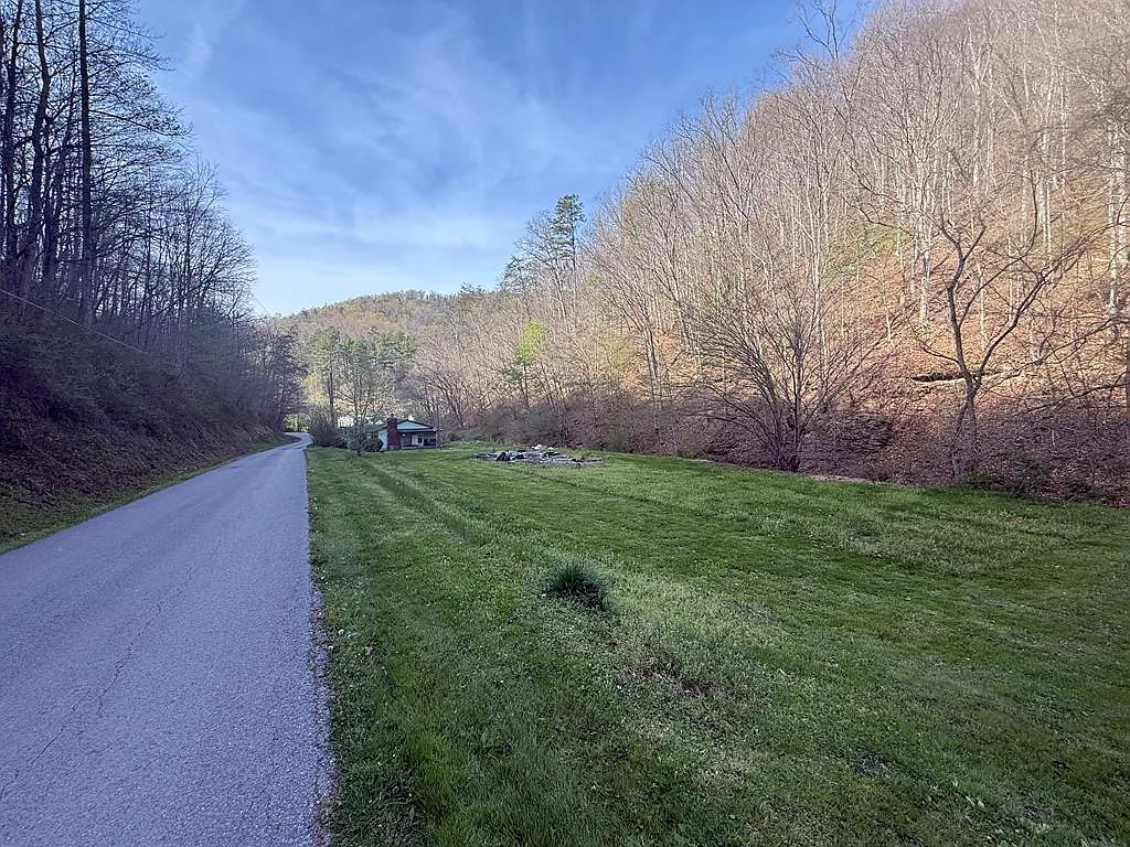
The physical layout of 1083 Left Fork Toler Crk offers two distinct functional areas, giving the property a dual-utility profile.
The Frontage Road Building Pad
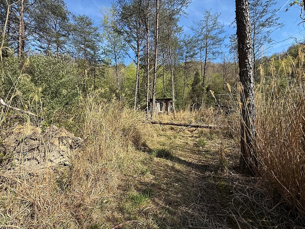
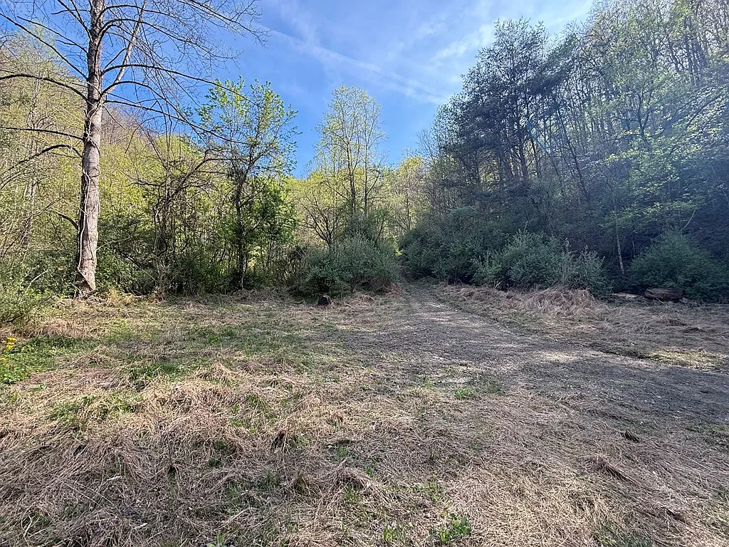
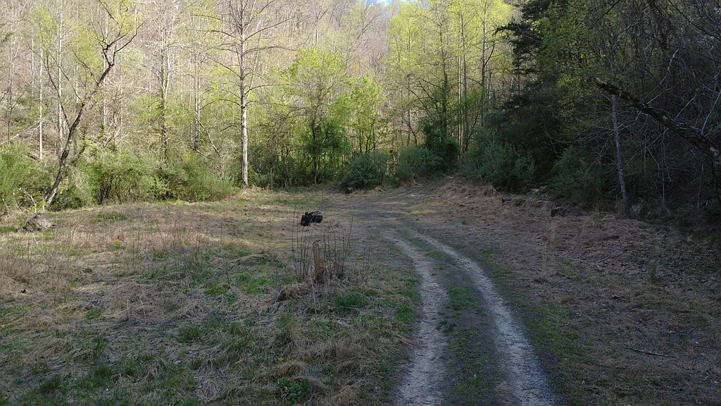
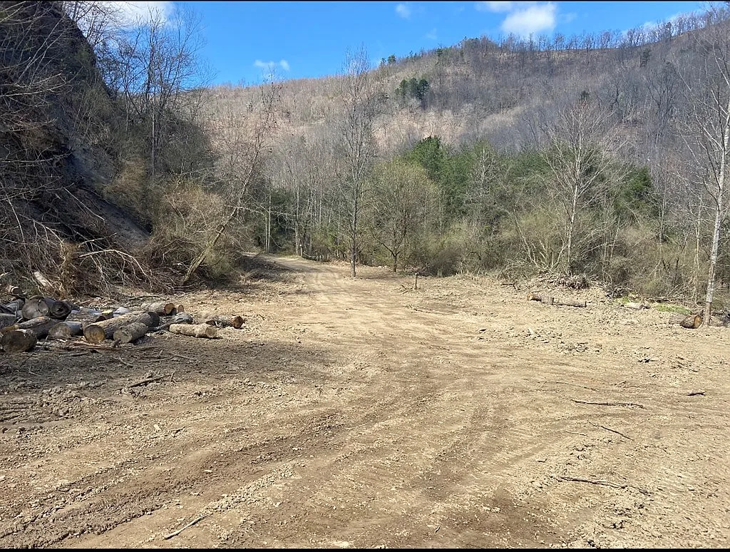
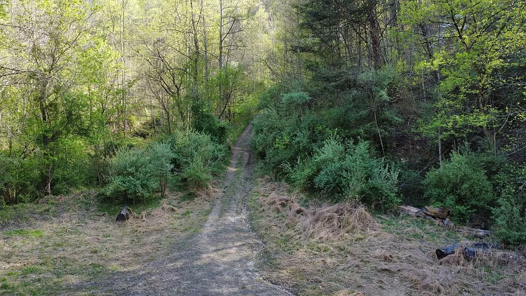
The listing highlights an accessible lot located directly off the main road (Left Fork Toler Creek Road) that is ready for home site development.
- Access Convenience:Building near the main road avoids the substantial earthmoving expenses associated with carving long mountain driveways up steep ridges.
- Utility Proximity:The road frontage lot sits adjacent to existing electrical utility lines and public water lines, minimizing utility connection fees.
- Primary Residence Suitability:This front pad provides a logical location for a primary residence, modular home, barndominium, or double-wide home while keeping the remaining 140+ acres undisturbed behind the residence.
The Interior Mountain Wilderness
Behind the front building lot, the parcel extends back into 140+ acres of secluded mountain terrain.
- Privacy and Buffer:The mountain slopes form a natural barrier, isolating the interior from neighboring roads and hollows.
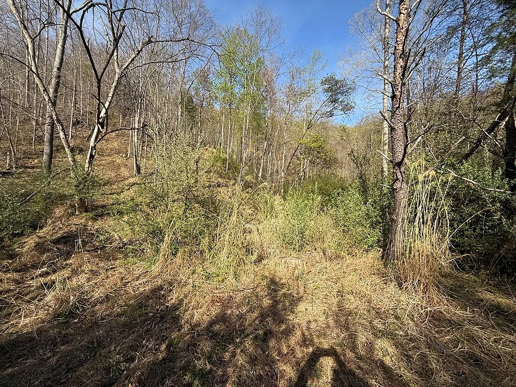
- Recreational Footprint:The interior acreage provides space for private off-road vehicle (ATV/UTV) trail networks, hiking trails, and hunting setups.
- Off-Grid Retreat Sites:Landowners seeking complete seclusion can clear interior mountain benches to construct off-grid hunting cabins, solar-powered shelters, or campsite pads away from the main road.
Topography, Forest Cover, and Environmental Characteristics
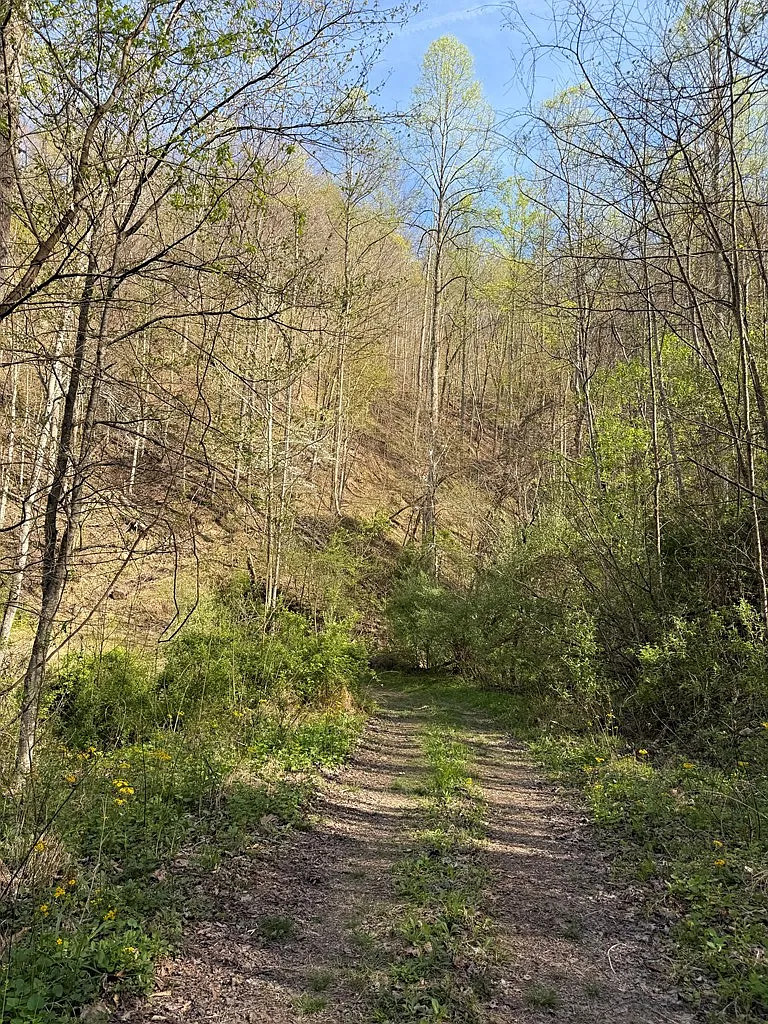
Floyd County forms part of the Dissected Cumberland Plateau, characterized by narrow valley floors bounded by steep, timbered ridge slopes and elevated benches.
- Valley Bottomland:The lowest elevation point of the property sits along Left Fork Toler Creek Road, where the primary building pad is located.
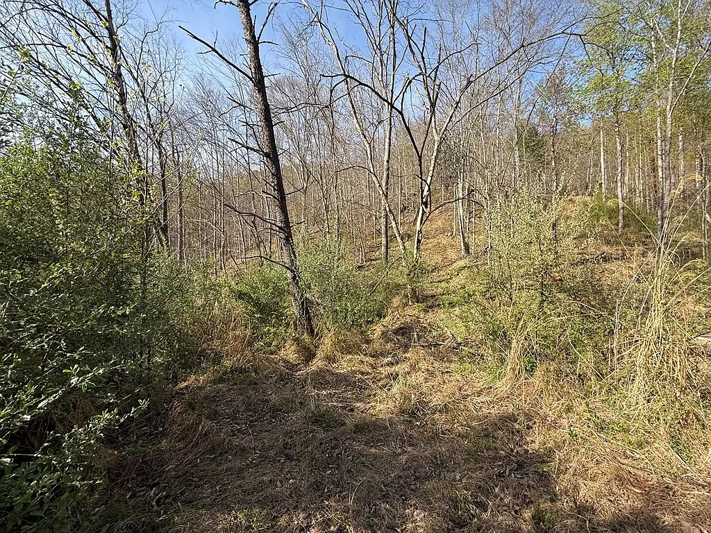
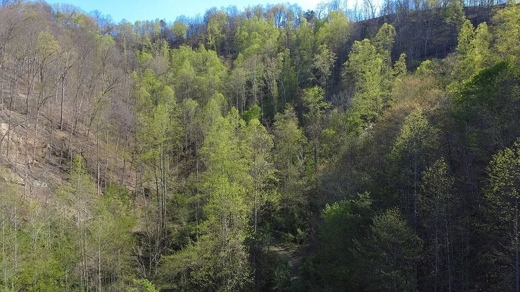
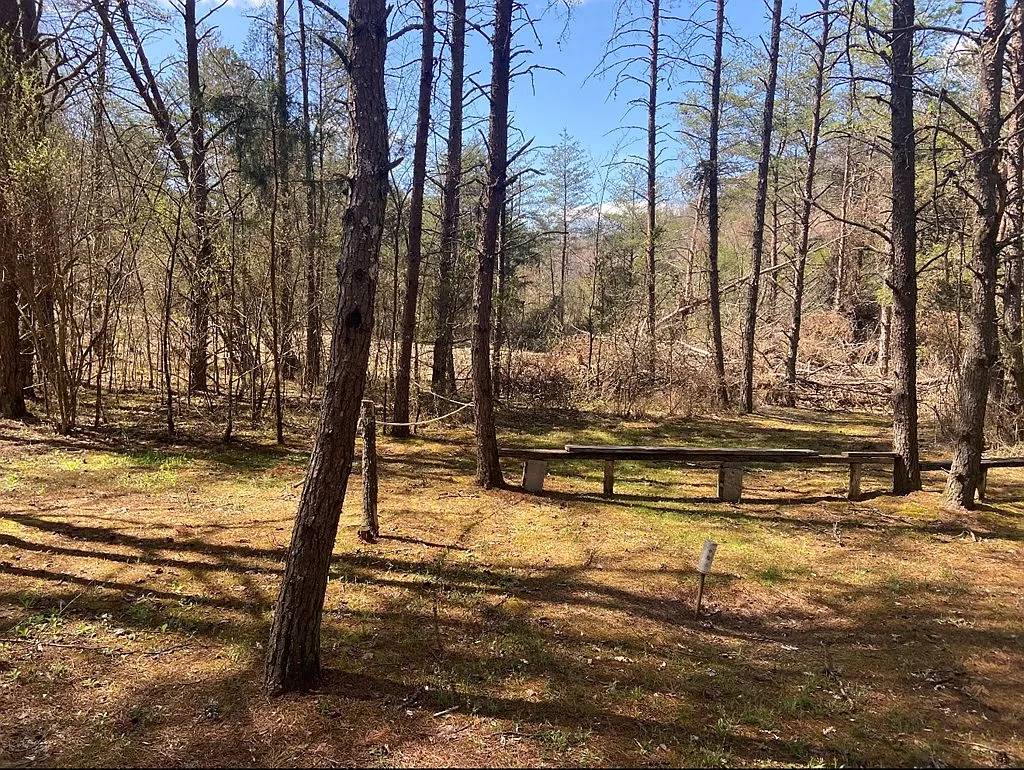
- Hillside Ridges:The majority of the 143 acres consists of heavily timbered mountain slopes.
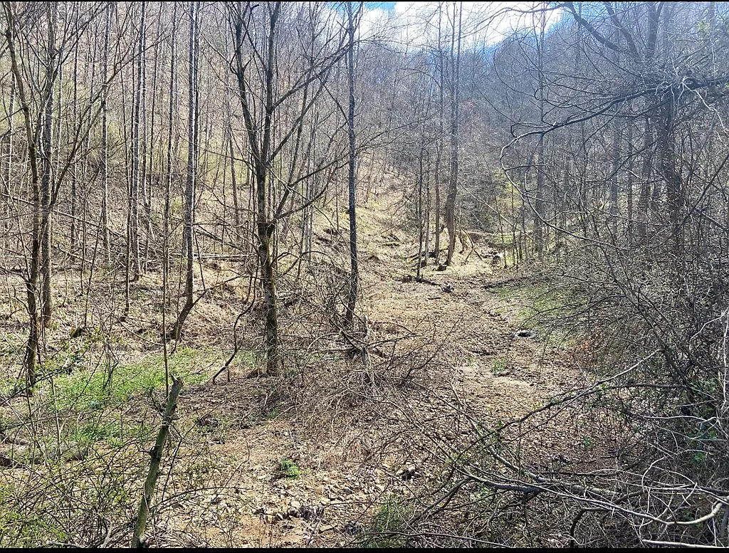
- Natural Bench Formations: Mountain ridges in Eastern Kentucky frequently feature natural horizontal ledges (“benches”). These benches provide level areas along the slopes where interior trails can be cut or off-grid cabin pads established.
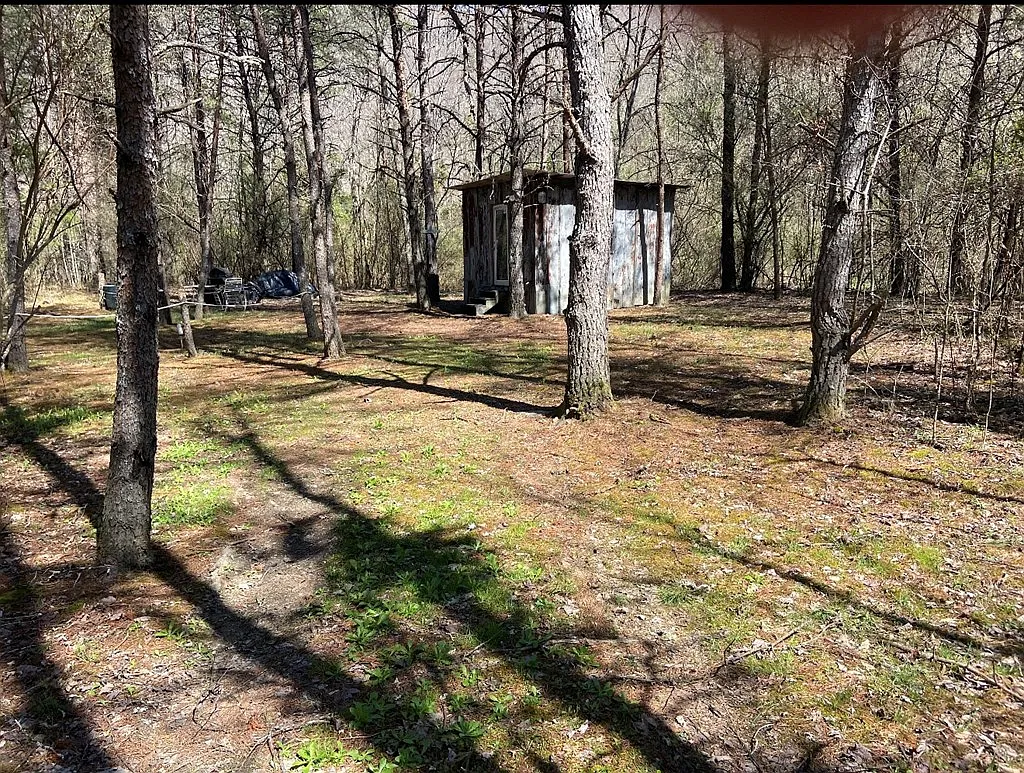
The property is covered in native Appalachian hardwood forest. Regional forests typically contain a mix of White Oak, Red Oak, Yellow Poplar (Tulip Tree), Sugar Maple, Hickory, and Beech. A professional timber evaluation (“timber cruise”) can determine standing commercial sawtimber volume and age.
Dense canopy cover, native acorn mast, and natural mountain drainage create an ideal habitat for native East Kentucky game.The area supports healthy populations of white-tailed deer, wild turkey, eastern black bear, and small game, making the parcel a candidate for a private hunting preserve.
Boundary Survey Requirement
The listing description explicitly includes a disclaimer: “Buyer to satisfy self of exact acreage and property lines.”
In rural mountain regions, historical deeds often rely on metes-and-bounds descriptions referencing natural landmarks like trees, rocks, or ridge tops. Over decades, physical landmarks shift or disappear. Ordering a professional boundary survey by a licensed Kentucky land surveyor is an essential step during due diligence to verify total acreage, locate property corners, and prevent boundary disputes with neighboring landowners.
Home Site, Infrastructure, and Utility Analysis
Developing raw land requires bridging the gap between bare ground and functional residential living.Evaluating 1083 Left Fork Toler Crk reveals specific utility assets and requirements.
- Public Water:Available along Left Fork Toler Creek Road.
- Electrical Power:Available along main road frontage.
- Wastewater System:Private septic tank required (See Agent Comments).
- Road Frontage:Direct access off Left Fork Toler Creek Road.
- Zoning:None (Unrestricted rural land).
The Value of Public Water Access
One of the most significant infrastructure assets of this listing is the availability of public municipal water along the main road frontage.
In many rural mountain areas, homeowners must drill private water wells. Drilling a deep water well in Appalachian mountain terrain carries hydrological risks—well depths can exceed 300 to 500 feet, costs can range from $8,000 to $15,000, and finding adequate flow rates (gallons per minute) or mineral-free water is never guaranteed. Having a public water main at the road frontage removes well-drilling uncertainty and saves substantial upfront capital.
Wastewater Management: Navigating Septic Requirements
Because municipal sewer service is unavailable along Left Fork Toler Creek, residential development requires a private septic system.
- Soil Percolation (“Perc”) Testing: Before installing a septic tank and drain field, the buyer must hire a certified sewage enforcement officer or county health department inspector to perform soil percolation testing on the front building lot.
- Drain Field Placement: Soil in Appalachian valley floors often contains alluvial silt and clay. Ensuring adequate drain field sizing and proper slope clearance is critical for receiving septic permit approval from the Floyd County Health Department.
- Estimated Septic Installation Costs: Installing a standard 1,000-gallon gravity-fed septic system in Eastern Kentucky typically ranges between $8,000 and $14,000, depending on soil test results and site excavation requirements.
Driveway and Site Grading Requirements
While the front lot offers road frontage, preparing the site for construction requires excavation:
- Culvert Installation: Installing an approved corrugated steel or plastic driveway culvert along the road ditch to handle storm runoff during heavy rains.
- Pad Clearing and Gravel: Clearing brush, leveling a building pad, and spreading crushed limestone gravel for parking and construction equipment access (typically $4,000 to $8,000 depending on pad size).
Comparing Raw Land Development Against Improved Options
Comparing 1083 Left Fork Toler Crk against the cost of purchasing smaller pre-developed tracts highlights its financial positioning.
Hypothetical Pre-Serviced Small Tract Scenario
A buyer purchasing 5 acres of pre-serviced land with a driveway, septic tank, public water tap, and cleared pad in Floyd County might pay $60,000 ($12,000 per acre). While the site is ready for immediate home placement, the buyer receives a limited land footprint.
Subject Property Scenario (1083 Left Fork Toler Crk)
- Listed Purchase Price:$139,000 (143 Acres)
- Public Water Tap & Line Connection: $2,500
- Site Excavation & Gravel Building Pad: $6,000
- Soil Testing & Septic System Installation: $11,000
- Electrical Service Drop: $2,500
- Combined All-In Site Infrastructure Investment: $161,000
Under this scenario, spending approximately $161,000 total delivers a utility-serviced building site paired with an expansive 143-acre private mountain backland.This yields an effective all-in cost of roughly $1,126 per acre for a developed 143-acre compound—demonstrating the long-term equity potential of buying large raw land tracts and adding infrastructure strategically.
Why This Property May Stand Out
Highlighting the main strengths of this listing reveals why it represents a notable opportunity in the Floyd County market:
- Sub-$1,000 Per Acre Valuation:At $139,000 for 143 acres ($972/acre), the entry price sits well below regional land averages.
- Public Water Availability:Connected public water at the road frontage eliminates the high cost and uncertainty of drilling private water wells.
- Dual-Utility Footprint:Features an accessible front lot for a home site alongside 140+ acres of private mountain wilderness.
- Ultra-Low Holding Overhead:Annual property taxes of $349 per year ($29/month) make long-term land banking strain-free.
- Hunting and Recreational Freedom:Abundant native wildlife and large acreage provide space for hunting, hiking, and off-road trail creation.
- Zero HOA or Community Restrictions:Freedom to build a custom house, place a manufactured home, construct outbuildings, or establish campsites without subdivision fees or design rules.
- Recent $20,000 Price Discount:Active price cuts demonstrate seller motivation and increase buyer negotiation leverage.
Potential Drawbacks and Risk Factors
A comprehensive real estate evaluation must analyze potential limitations so prospective buyers can plan accordingly.
- Unsurveyed Acreage Boundary Risk:The listing explicitly states that the buyer must satisfy themselves regarding exact property lines and acreage through a survey. Unsurveyed mountain tracts can carry boundary line discrepancies.
- Predominantly Steep Topography:The vast majority of the 143 acres consists of steep mountain slopes, limiting broad agricultural use or traditional subdivision development.
- Septic System Dependency:Absence of public sewer requires formal soil percolation testing and septic system installation before residential building permits can be issued.
- Site Preparation Overhead:Cutting interior ATV trails, clearing building pads, and installing driveway culverts require physical labor or earthmoving equipment.
- Financing Dynamics for Raw Land: Securing a conventional residential mortgage on raw, unimproved land without a dwelling can be challenging. Buyers typically require cash reserves, higher down payments (20% to 30%), or specialized land loans through regional agricultural credit institutions.
Who Is This Property Best For?
Matching property characteristics with buyer goals clarifies who will derive the highest utility from 1083 Left Fork Toler Crk.
Ideal Buyer Candidates
- Recreational Hunters & Outdoorsmen:Seeking an affordable private hunting preserve with massive acreage scale, native game populations, and ATV trail potential.
- Value-Driven Land Bankers:Seeking a 140+ acre tangible land hedge with ultra-low $349/year holding costs.
- Off-Grid Homesteaders & Custom Builders:Wanting public water access at the road with room for a home pad and private mountain backland.
- Adjoining Landowners & Timber Investors:Looking to expand regional boundaries or manage long-term hardwood timber reserves.
Who Should Consider Looking Elsewhere?
- Turn-Key Residential Buyers:Anyone looking for a move-in-ready home requiring zero site work or construction.
- Suburban or Flat-Land Buyers:Individuals seeking level farmland or paved subdivision neighborhoods.
- Buyers Lacking Cash or Land Financing: Buyers relying on strict FHA, VA, or standard 3% down residential home loans.
Strategic Investment and Land Stewardship Perspective
From a long-term investment standpoint, 1083 Left Fork Toler Crk operates as a versatile land asset.
Tangible Asset Stability
Land is a finite physical resource. Securing 143 contiguous acres at $972 per acre provides a durable physical asset base.While real estate cycles fluctuate, large tracts of land with road frontage and public water access maintain steady demand among buyers seeking space, privacy, and natural resources.
Low Holding Cost Efficiency
The annual property tax bill of $349 ($29/month) is a major financial advantage. Many large acreage parcels in surrounding states carry thousands of dollars in annual property taxes. A $29 monthly holding cost allows an owner to hold the land long-term without financial strain while making site improvements or awaiting timber maturity.
Phased Development Roadmap
For a buyer acquiring 1083 Left Fork Toler Crk, executing a structured stewardship plan will maximize long-term land utility and asset value:
- Phase 1: Boundary Verification & Survey:Commission a professional land survey to mark property corners, blaze boundary lines, and establish exact surveyed acreage.Perform a title search to confirm clear ownership and verify subsurface mineral rights status.
- Phase 2: Front Pad Buildout:Apply for a public water tap connection, perform soil percolation testing, obtain a septic permit, and install a driveway culvert and gravel parking pad.
- Phase 3: Interior Trail Creation:Hire an excavator operator to cut a primary 8-to-10-foot wide interior access trail from the front pad up onto main mountain benches for ATV riding, hunting access, and timber management.
What Buyers Should Verify Before Purchasing
Executing thorough pre-offer due diligence protects buyers from unexpected expenses. Prospective buyers should complete the following technical verification steps:
- Boundary Survey Order:Obtain cost estimates from licensed Kentucky surveyors to conduct a boundary survey on the 143 acres.
- Title Search and Mineral Rights Verification: Have a real estate attorney confirm clear title and verify whether subsurface mineral, oil, and gas rights convey with the surface title.
- Public Water Tap Confirmation:Contact the local public water utility to confirm water line location, water pressure, and tap connection fees along Left Fork Toler Creek Road.
- Soil Percolation Testing:Consult with a certified septic installer or county health official to inspect soil suitability on the front building lot.
- Physical Site Walkthrough:Walk the property in person using handheld GPS mapping software (such as OnX Hunt, LandGlide, or Regrid) to inspect the front building pad, elevation rises, and creek drainage patterns.
- Floyd County Tax Assessment Review:Verify current property tax records ($349/year) with the Floyd County Property Valuation Administrator (PVA).
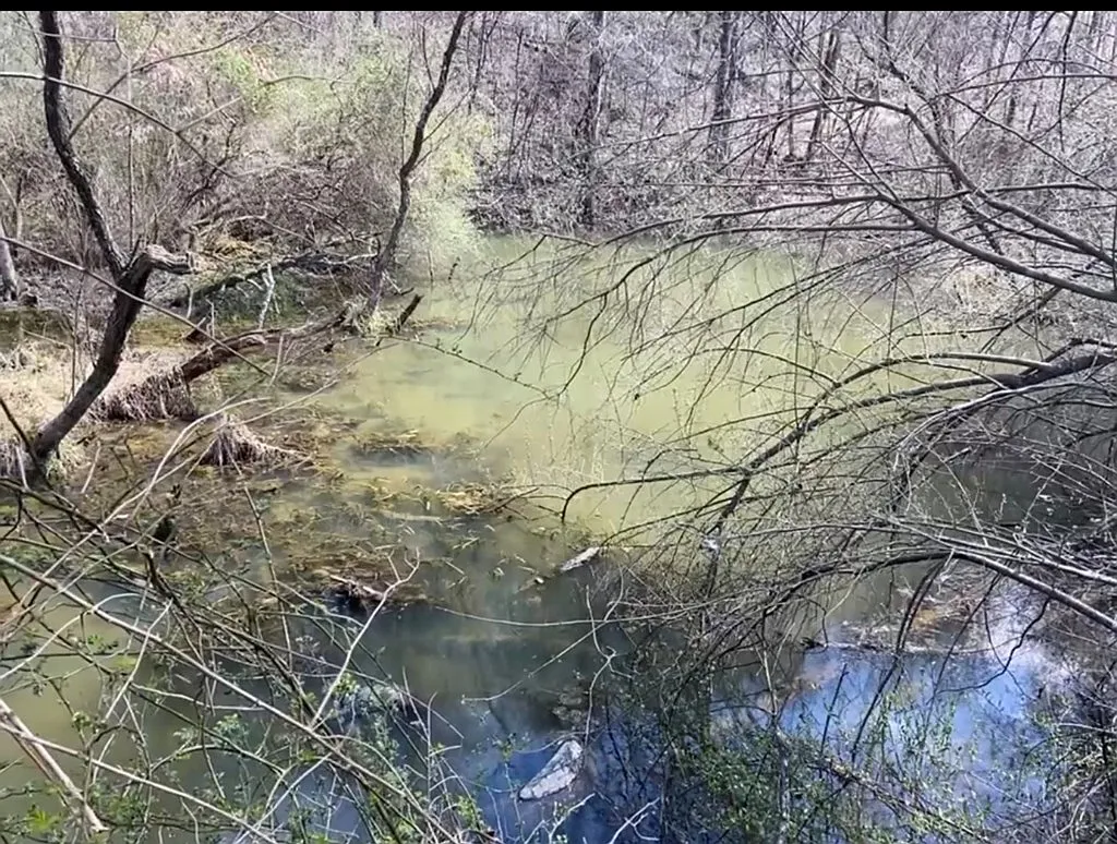
- Flood Zone Mapping:Review FEMA flood hazard maps to ensure the front building pad sits safely above high-water creek drainage lines.
- Electrical Service Drop Estimate:Contact the local electric distribution cooperative to confirm service drop connection rules and costs along the main road.
- Access Easement Verification:Confirm that road frontage along Left Fork Toler Creek Road provides unencumbered public access without crossing third-party private drives.
- Financing Pre-Approval: If financing, secure written pre-approval from a specialized land lender or regional bank comfortable with raw acreage transactions.
Final Verdict
1083 Left Fork Toler Crk represents a compelling value opportunity in the Eastern Kentucky land market.Listed at $139,000 for 143 acres ($972 per acre), its primary strength lies in its combination of scale, low entry price, and public water availability.
By providing connected public water access along the main road frontage, the property eliminates the substantial costs and risks associated with drilling private water wells.The front lot offers an accessible building pad for a home, while the 140+ acres of secluded mountain terrain behind it provide an expansive domain for hunting, recreation, or long-term land banking.The ultra-low $349 annual property tax liability ensures minimal ongoing holding costs, and the recent $20,000 price discount enhances buyer negotiation leverage.
The primary trade-offs stem from its steep mountain topography, the requirement for an independent boundary survey, and the need to install a private septic system for wastewater disposal.
For hunters, off-grid homesteaders, land-banking investors, or buyers seeking an affordable mountain retreat in Floyd County under $150,000, 1083 Left Fork Toler Crk is well worth an on-site physical walk-through and thorough due diligence review.
Listed on Zillow