At $645.30 per acre for 230.9 surveyed acres—including over 2,100 feet of owned frontage on the Passadumkeag River—Lot 14 Whitetail Way in Lowell, Maine represents one of the lowest per-acre entry points for large-tract waterfront land in Penobscot County.Located two miles off paved access, this parcel combines extreme privacy, four-season recreational trail access, pre-cleared former wood yard staging areas, and negligible annual carrying costs of $500 per year ($41.67 per month).
Property Specification Summary
| Property Parameter | Official Listing & Registry Disclosures |
| Property Address | Lot 14 Whitetail Way, Lowell, ME 04493 |
| County / Regional Market | Penobscot County / Lincoln Regional Submarket |
| Current Asking Price | $149,000 (Reduced by $10,000 on August 11, 2026) |
| Original List Price | $189,000 (Listed April 30, 2026) |
| Total Price Cut | -$40,000 (-21.16% cumulative reduction) |
| Total Surveyed Acreage | 230.90 Acres (10,058,004 Square Feet) |
| Price Per Acre | $645.30 per acre |
| Price Per Square Foot of Land | $0.0148 per sq. ft. (under 1.5 cents/sq. ft.) |
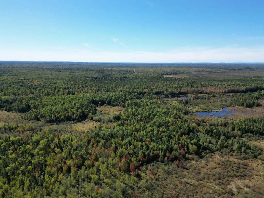
| Waterfront Ownership | ~2,127 to 2,270 Feet of Owned Frontage on Passadumkeag River |
| Price Per Waterfront Foot | $70.05 per linear foot (allocating 100% value to riverfront) |
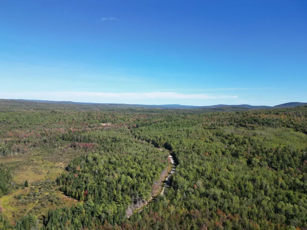
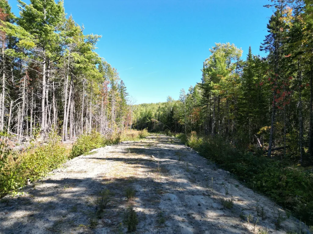
| Access & Road Type | 2 Miles Off Pavement; Private Gravel/Dirt Road (Whitetail Way) |
| Electrical Utility | 100% Off-Grid (No Grid Electric Connection) |
| Wastewater & Water | No Septic Installed (Soil Test Available); Private Well Needed |
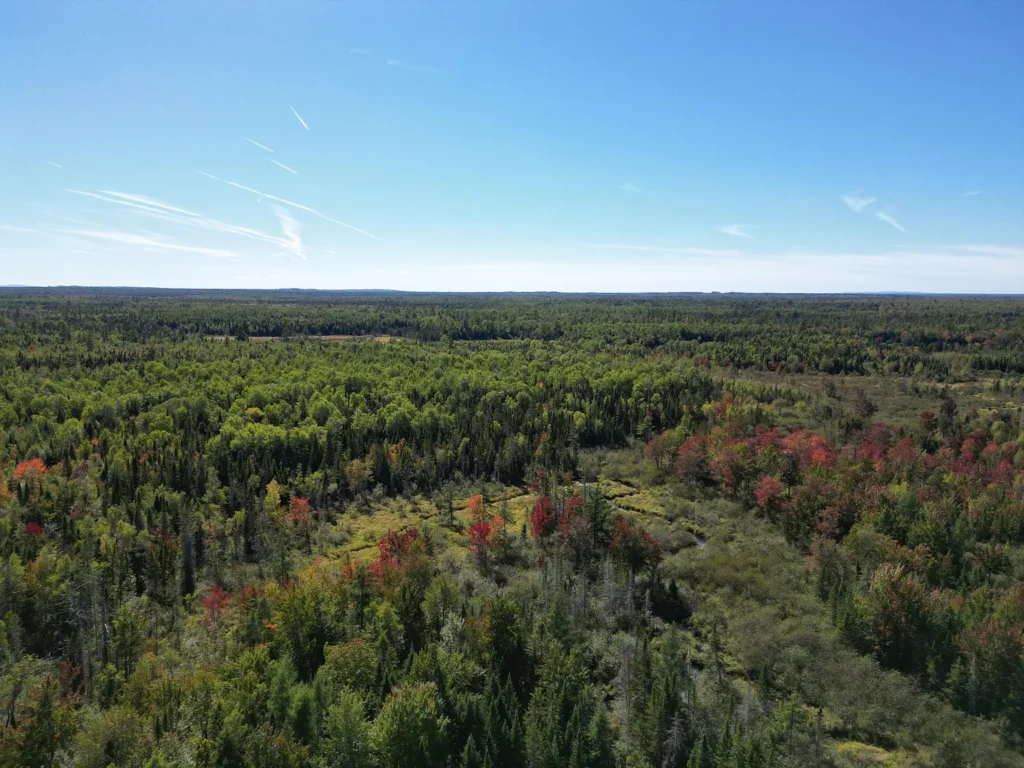
| Terrain & Topography | Rolling Slope, Mixed Forest Canopy, Former Wood Yards |
| Annual Property Taxes | $500.00 per year ($41.67 per month / $2.16 per acre annually) |
| HOA Fees | None ($0.00) |
| Recreational Access | Direct access to regional ATV and snowmobile trail networks |
| Financing Terms | Possible Owner Financing Available |
| MLS Identifier | Maine Listings MLS #1659986 |
Financial Metrics and Price Trajectory Analysis
Evaluating a 230.9-acre land tract requires analyzing purchase metrics per unit area, price drop patterns over time, and long-term tax holding efficiency.
Valuation and Per-Unit Calculations
- Asking Price: $149,000
- Price Per Acre:$149,000 ÷ 230.9 acres = $645.30 per acre
- Price Per Square Foot: $149,000 ÷ 10,058,004 sq. ft. = $0.0148 per sq. ft.
- Waterfront Valuation: At 2,127 feet of Passadumkeag River frontage, the land trades at $70.05 per linear foot of waterfront if zero value is assigned to the remaining 230 acres.
In rural Penobscot County, raw forestland tracts with deeded road access typically trade between $1,000 and $1,800 per acre, while riverfront parcels frequently carry substantial premiums. An asking price of $645.30 per acre reflects a 35% to 60% discount below average rural acreage benchmarks, directly pricing in its off-grid nature and unpaved access corridor.
Price History and Market Re-Indexing
Reviewing the listing trajectory across the 2026 sales cycle highlights aggressive seller re-indexing over a 103-day period:
| Date | Listing Status / Event | Listing Price | Per-Acre Rate | Net Adjustment |
| April 30, 2026 | Initial Listing | $189,000 | $818.54 / acre | Baseline Launch Price |
| June 17, 2026 | Price Cut | $179,000 | $775.23 / acre | -$10,000 (-5.29%) |
| July 13, 2026 | Price Cut | $169,000 | $731.92 / acre | -$10,000 (-5.59%) |
| August 6, 2026 | Price Cut | $159,000 | $688.61 / acre | -$10,000 (-5.92%) |
| August 11, 2026 | Price Cut | $149,000 | $645.30 / acre | -$10,000 (-6.29%) |
The cumulative price reduction of $40,000 (-21.16%) demonstrates strong seller motivation to liquidate. The step-down pattern of $10,000 cuts every 3 to 4 weeks indicates that the seller is systematically testing market clearing prices to find cash buyers or buyers utilizing owner financing.
Property Tax Holding Efficiency
Public tax records reveal an exceptionally low carrying cost structure:
- Annual Property Tax Bill: $500.00 per year
- Monthly Property Tax Burden: $500 ÷ 12 = $41.67 per month
- Annual Tax Cost Per Acre: $500 ÷ 230.9 acres = $2.16 per acre annually
At $41.67 per month, holding costs are negligible. An investor or recreational buyer can hold this 230.9-acre footprint indefinitely with virtually zero carrying risk while formulating land-use, timber harvesting, or off-grid homestead plans.
Land Topography, Natural Resources, and Off-Grid Mechanics
The physical characteristics of Lot 14 Whitetail Way define its operational utility for off-grid living, forestry, and recreation.
Passadumkeag River Frontage (~2,127 Feet)
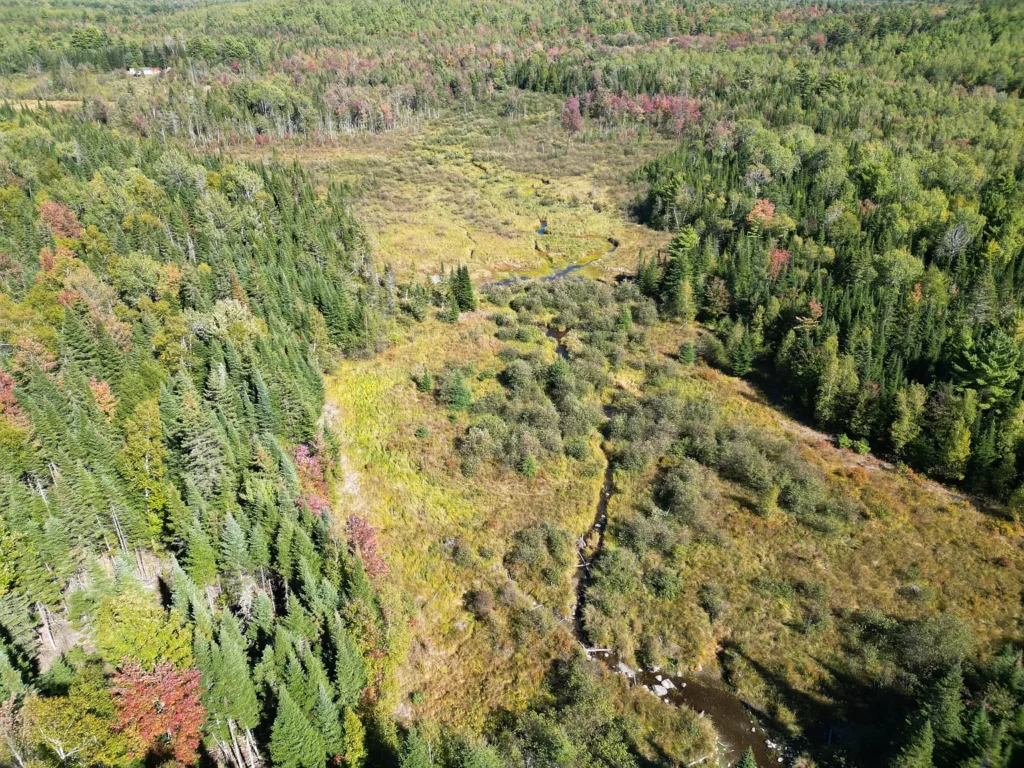
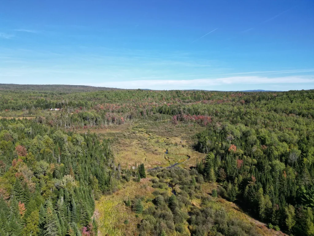
The parcel features approximately 2,127 to 2,270 feet of direct, owned frontage on the Passadumkeag River.
- River Character: The Passadumkeag River is a medium-gradient, cold-water northern Maine stream that feeds into the Penobscot River basin. It offers opportunities for brook trout and warm-water species fishing, canoeing, kayaking, and waterfowl habitat.
- Shoreland Zoning Constraints: Development along Maine waterbodies is governed by Mandatory Shoreland Zoning regulations. Structures, septic fields, and major timber clearing generally require a minimum 75-foot to 250-foot setback from the high-water mark, preserving riverbank ecology while dictating cabin placement.
Reclaimed Wood Yards and Forest Canopy
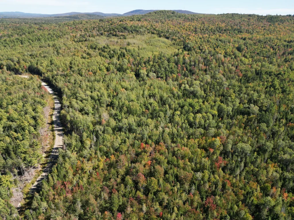
- Former Log Landing Areas:The property includes established, cleared wood yard staging sites resulting from historical timber harvests. These clearings save thousands of dollars in initial excavation costs, providing flat, pre-compacted building envelopes for an off-grid cabin, pole barn, solar array, or RV pads.
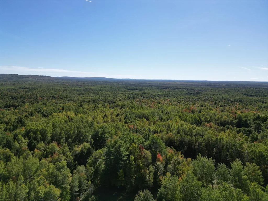
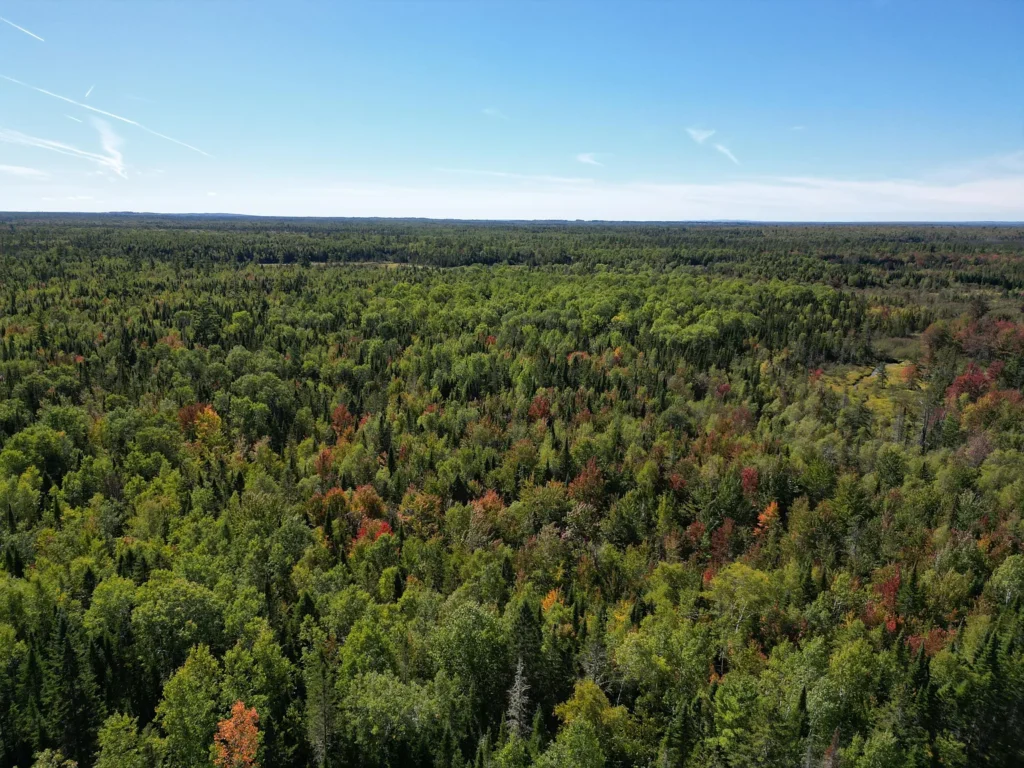
- Timber Composition: Outside the open staging areas, the terrain rises gently across rolling slopes clad in mixed northern hardwoods (birch, maple, aspen) and softwoods (spruce, fir). A selective forest management plan can yield ongoing firewood supply or periodic commercial timber revenue.
Off-Grid Power and Utility Setup Requirements
Because the parcel sits two miles off the main power grid, traditional grid electrification is economically unfeasible (line extension costs in rural Maine average $15,000 to $30,000+ per mile across private woods roads).
- Solar Photovoltaic Feasibility:The property features a high Sunscore rating (96/100) with minimal shading across former timber yard clearings. A 5kW to 10kW off-grid ground-mounted solar array paired with lithium iron phosphate (LiFePO4) battery storage provides sufficient electric power for modern cabin infrastructure.
- Wastewater & Soil Testing:Official disclosures indicate a soil test is available. In Maine, a passed soil test (Form HHE-200) confirms that suitable subsurface soils exist for a conventional leach field and septic tank installation, clearing a critical hurdle for building permits.
- Water Supply: Domestic water supply requires drilling a private bedrock well or constructing a shallow point/spring system subject to local code approvals.
Comparative Value Analysis: Subject Property vs. Market Alternatives
To measure the value proposition of $149,000, consider how Lot 14 compares to alternative rural Maine acreage configurations:
| Capital & Site Parameter | Lot 14 Whitetail Way (Subject Property) | Raw 50-Acre Inland Lot (Accessible Grid) | Small 5-Acre Waterbody Lot |
| Acquisition Cost | $149,000 | $95,000 | $85,000 |
| Total Acreage | 230.90 Acres | 50.00 Acres | 5.00 Acres |
| Price Per Acre | $645.30 / acre | $1,900.00 / acre | $17,000.00 / acre |
| Water Frontage | ~2,127 Feet (River) | Zero Feet (Landlocked/Inland) | 200 Feet (Pond/River) |
| Grid Power Distance | 2.0 Miles Off-Grid | At Street | At Street |
| Annual Tax Burden | $500 / year | $900 / year | $1,400 / year |
| Recreational Privacy Scale | High Privacy Buffer | Moderate Privacy Buffer | Low Privacy Buffer |
Financial Takeaway
While smaller parcels with grid power offer immediate plug-and-play convenience, Lot 14 delivers 4.6 times more acreage and 10 times more water frontage than typical mid-tier land listings at a lower baseline cost per acre. The $645/acre price tag leaves substantial capital headroom for buyers to install custom solar infrastructure and private water/septic systems.
Advantages and Potential Drawbacks
Key Property Advantages
- Unusually Low Unit Cost:Offered at $645.30 per acre, representing a significant discount for surveyed Maine land.
- Substantial River Frontage:Over 2,100 feet of direct, owned water frontage on the Passadumkeag River.
- Negligible Tax Carrying Costs: Property taxes of $500 per year ($41.67/month) minimize financial holding risk.
- Pre-Cleared Building Pads: Reclaimed former wood yards eliminate heavy clearing costs for initial site development.
- Four-Season Trail Access:Direct connectivity to regional ATV networks and proximity to snowmobile corridors.
- Owner Financing Potential:Listing notes possible owner financing, opening options for buyers seeking alternative land terms.
Potential Risk Factors and Drawbacks
- No Grid Electric: Requires complete off-grid power solutions (solar, generator, battery banks).
- Unpaved Access Road: Located two miles down a private gravel/dirt road, requiring 4WD vehicles and private snowplowing arrangements during heavy winter snowstorms.
- Shoreland Setback Restrictions: Building near the Passadumkeag River requires strict adherence to Maine Shoreland Zoning setbacks.
- Distance from Major Metro Hubs:Located 20 minutes from Lincoln, ME for daily services, and approximately 50 minutes north of Bangor.
Target Buyer Profiles: Who Fits This Property Best?
| Buyer Category | Profile Characteristics | Compatibility Fit |
| Off-Grid Homesteaders & Cabin Builders | Buyers seeking a large private land holding to establish a solar-powered homestead or recreational timber cabin. | Ideal Fit |
| Four-Season Outdoor Enthusiasts | Hunters, ATV riders, snowmobilers, and anglers needing direct trail access and river fishing out their front door. | Ideal Fit |
| Long-Term Timber & Land Speculators | Investors looking to bank 230+ acres at $645/acre with minimal $500/year tax holding costs. | Ideal Fit |
| Suburban Turnkey Homebuilders | Buyers requiring paved street access, municipal sewer, and traditional grid power drops. | Unfavorable Fit |
Essential Buyer Due Diligence Checklist
Prospective purchasers should execute the following technical verification steps prior to submitting a cash or financed offer:
- Review Boundary Survey: Examine the complete professional survey map for Lot 14 to locate all corner pins, boundary lines, and access easements along Whitetail Way.
- Review Soil Test Results (HHE-200 Form): Obtain the available soil test documents from the listing agent to verify test pit locations and suitable septic system design specifications.
- Audit Access Rights and Road Maintenance Agreements: Confirm deeded ingress/egress rights over Whitetail Way and check for any shared gravel maintenance agreements among lot owners.
- Verify Shoreland Zoning Boundaries: Consult with the Town of Lowell Code Enforcement Officer to map municipal Shoreland Zoning setback buffers along the Passadumkeag River.
- Confirm Owner Financing Terms (If Applicable): If utilizing seller financing, review proposed down payment requirements, interest rates, amortization schedules, and balloon payment clauses.
Final Verdict
Lot 14 Whitetail Way in Lowell, Maine presents an extraordinary acreage-to-price ratio. Offered at $149,000 ($645.30 per acre) for 230.9 surveyed acres with over 2,100 feet of Passadumkeag River frontage, its primary competitive strengths lie in its privacy, low $41.67/month taxes, direct ATV trail access, and pre-cleared wood yard pads.
The primary trade-offs are its 100% off-grid status and two miles of unpaved road access.For off-grid homesteaders, outdoorsmen, or long-term land investors, this recently reduced listing offers substantial land equity and recreational utility in Northern Maine.
Listed on Zillow