Priced at $89,000—which calculates to $2,225.00 per acre—this 40-acre unimproved land parcel on Nsa Charron Lane in Redding, California (ZIP 96003, Shasta County) presents an opportunity to acquire acreage in Northern California. Listed on September 4, 2026, via SMLS #26-4649 following a price adjustment from its previous $87,500 listing price in 2025, the property offers a combination of rolling topography, natural stream corridors, foothill timber canopy, and panoramic mountain views.
Located in the scenic northeast quadrant of Redding, the parcel provides privacy and seclusion while maintaining reasonable proximity to urban services, healthcare facilities, and retail centers in central Redding. Positioned in the Shasta County foothills, this undeveloped tract caters to off-grid homesteaders, private recreational land buyers, and long-term land-banking investors seeking sizeable acreage under $2,500 per acre in California.
Property Specifications & Core Technical Baseline
Evaluating Shasta County public records, GIS mapping, and regional MLS listing disclosures establishes the technical baseline for this Northeast Redding acreage.
| Property Parameter | Listing Disclosures & County Public Data Baseline |
| Street Address | Nsa Charron Ln, Redding, CA 96003 |
| County / Region | Shasta County / Northeast Redding Foothills |
| Parcel Identification (APN) | 306-440-003 |
| Current Asking Price | $89,000 (Relisted September 4, 2026) |
| Total Deeded Footprint | 40.00 Acres (1,742,400 Square Feet) |
| Price Per Acre | $2,225.00 per acre |
| Price Per Square Foot | $0.0511 per sq. ft. |
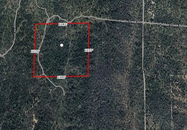
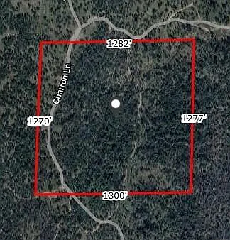
| Lot Dimensions | Approx. 1,282′ (North) x 1,277′ (East) x 1,300′ (South) x 1,270′ (West) |
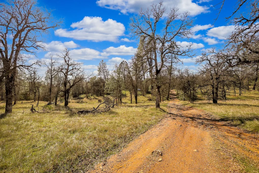
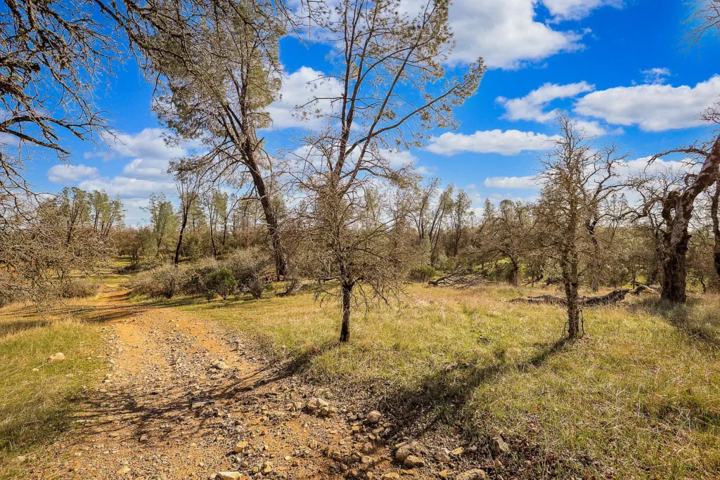
| Topography Profile | Gentle Slopes, Rolling Benches, Wooded Stream Valleys |
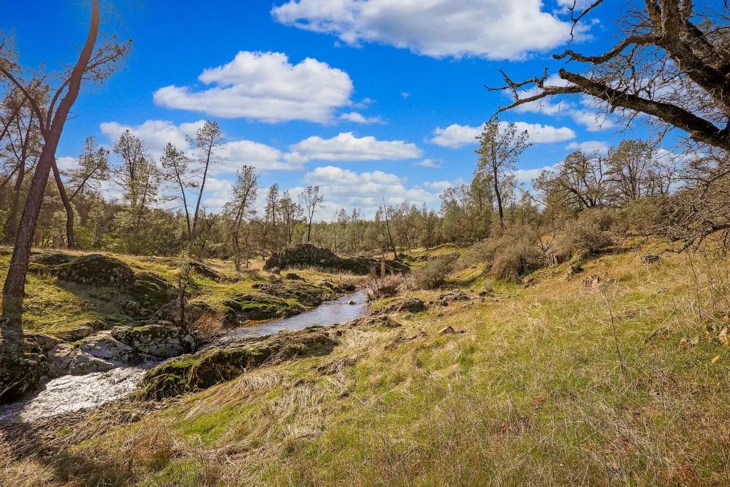
| Hydrology & Water Assets | Natural Seasonal/Year-Round Streams Flowing Through Parcel |
| Vegetation & Canopy Cover | Foothill Pine, Blue Oak, Native Chaparral & Brush |
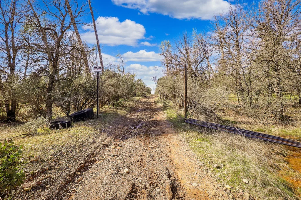
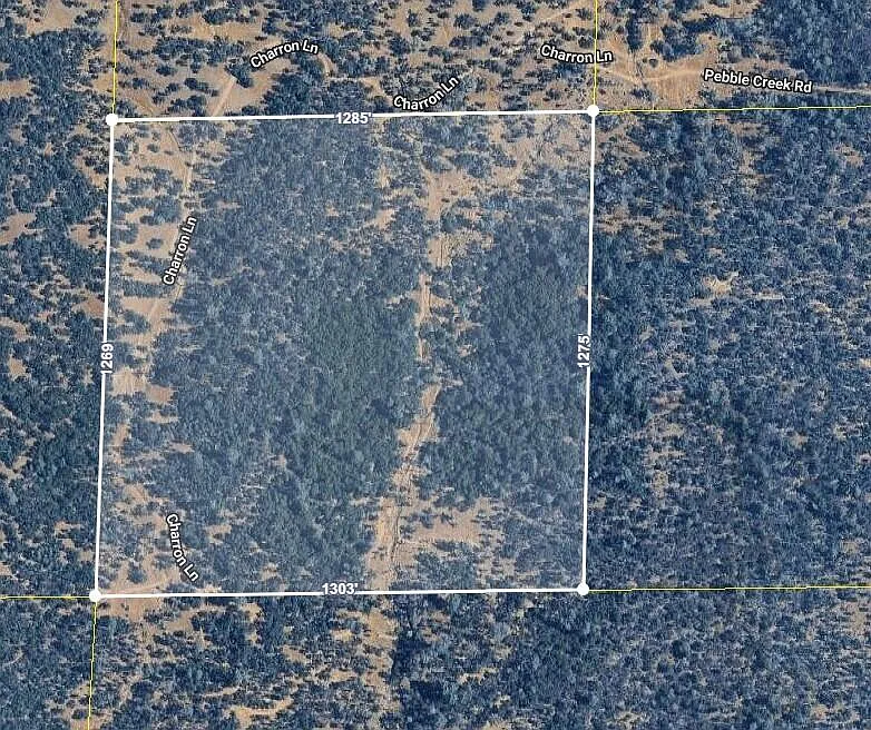
| Road Frontage & Access | Charron Ln Dirt/Gravel Corridor Crossing Western Portion |
| Utilities Status | Off-Grid / Unimproved (No Grid Power Connected, No Well, No Septic) |
| HOA / Association Fees | None ($0.00 / month) |
| Listing / Transaction Terms | Cash, Conventional Land Financing |
Unbundled Valuation & Asset Allocation Analysis
To evaluate the $89,000 purchase price, the property’s overall asset value can be separated across raw acreage, hydrology assets, topographic building envelopes, and regional access infrastructure.
| Asset Component | Estimated Value Allocation | Calculation Basis & Market Context |
| Raw Unimproved Land Basis (40 AC) | $56,000 | Assigned at $1,400/acre baseline for off-grid Shasta County brushland |
| Stream & Water Corridor Premium | $14,000 | Value uplift for natural stream drainages and riparian habitat |
| View Corridor & High-Ground Benches | $11,000 | Valuation premium for elevated building pads with mountain vistas |
| Road Alignment & Dirt Access | $8,000 | Value of existing dirt access alignment along Charron Lane |
| TOTAL ESTIMATED ASSET VALUE | $89,000 | Matches asking purchase price ($2,225.00 / acre basis) |
Tax Carrying Overhead
Holding unimproved land in Shasta County incurs low ongoing holding costs prior to site development:
- Estimated Annual Property Tax Bill: ~$950.00 to $1,150.00 per year (based on standard California Proposition 13 base assessment rates of ~1.1% to 1.25% of purchase price).
- Monthly Property Tax Overhead: ~$79.17 to $95.83 per month.
- HOA / Association Dues: $0.00 / month.
- Base Holding Cost: Under $100.00 per month, allowing investors to hold 40 acres in Northern California with minimal overhead holding risk.
Topography, Hydrology, & Natural Features Audit
1. Land Topography & Building Envelopes
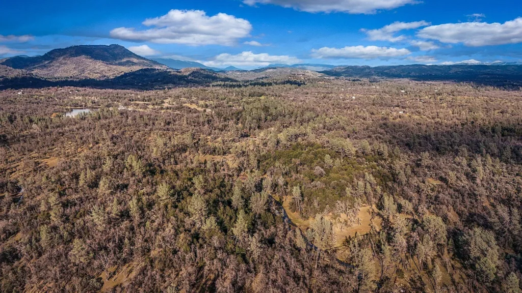
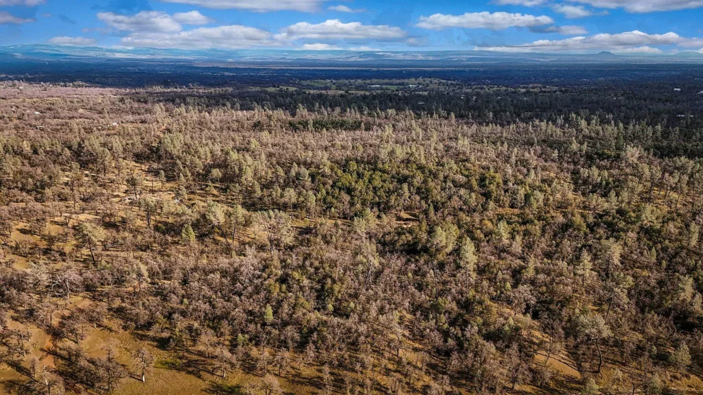
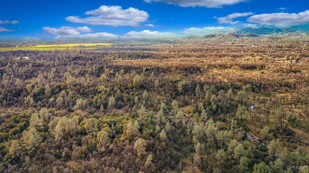
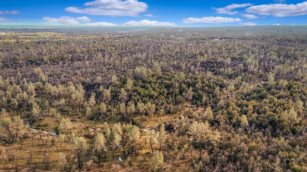
- Gentle & Rolling Contour: Aerial parcel mapping confirms a mix of level-to-gentle benches alongside rolling foothill slopes. This terrain distribution offers private building envelopes set back from Charron Lane without requiring extensive hillside grading.
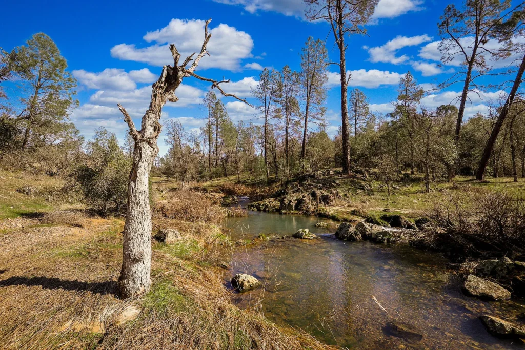
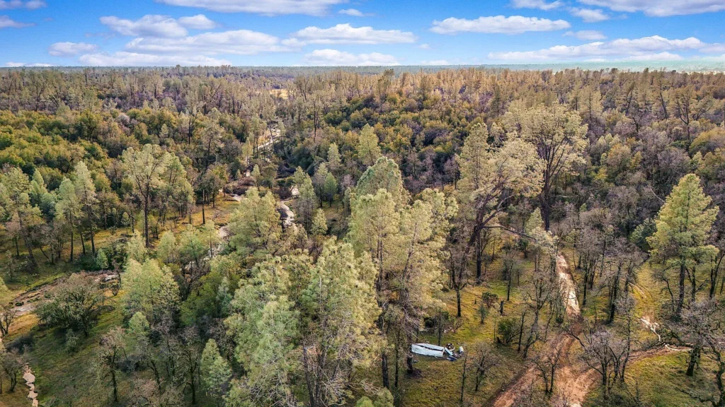
- Wooded Oak & Pine Canopy: The vegetation consists of native California Blue Oak, Foothill Pine (Digger Pine), and chaparral brush. Clearing select brush zones creates necessary fire defensible space while opening up view corridors.
2. Natural Water Resources & Hydrology
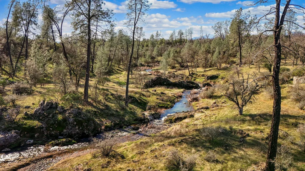
- Stream Corridors: Natural streams course through the property’s lower drainages. These water channels provide natural features, support local wildlife, and indicate potential shallow water table pockets for well drilling.
- Drainage Patterns: Future structures should be placed on elevated bench land above stream channels to comply with Shasta County setback requirements and avoid seasonal runoff zones.
3. Scenic Mountain Vistas
- Panoramic Foothill Views: Elevated points on the 40-acre parcel feature clear view sheds looking toward surrounding Northern California mountain ranges and valleys.
Projected Off-Grid Infrastructure & Development Budget (CapEx)
Because Nsa Charron Lane is currently unimproved off-grid land, developing the tract for residential occupancy or seasonal cabin use requires planned capital expenditures:
| Development / Upgrade Component | Low-End Estimate (DIY / Local) | High-End Estimate (Contractor) | Technical Scope & System Details |
| Private Water Well Drilling | $12,000 | $28,000 | Drill 200’–400′ foothill well, casing, pump & pressure tank |
| Off-Grid Solar Power Array | $6,500 | $18,500 | 5kW–10kW ground-mount solar panels with lithium storage bank |
| Engineered Septic System | $9,000 | $17,500 | Perk testing, septic tank placement & engineered leach field |
| Driveway Grading & Graveling | $3,500 | $8,500 | Re-grade access trail off Charron Ln & apply crushed rock base |
| Site Clearing & Defensible Space | $3,000 | $7,500 | Clear 100-foot defensible perimeter around home site (CAL FIRE rules) |
| TOTAL PROJECTED CAPEX | $34,000 | $80,000 | Estimated budget for full off-grid site infrastructure |
Regional Comparative Market Analysis (CMA)
Comparing Nsa Charron Lane against active and recently transacted land listings in Shasta County highlights its competitive market standing:
| Property Location & Details | Acreage | List Price | Price / Acre | Key Features & Access |
| Nsa Charron Ln, Redding, CA (Subject) | 40.00 AC | $89,000 | $2,225.00 | Streams; Mountain views; Dirt access; Off-grid |
| Bernard Way Area, Redding, CA | 14.83 AC | $199,000 | $13,418.75 | Paved access; Near utility drops; Higher price tier |
| Raw Acreage Tract, Anderson, CA | 40.40 AC | $85,000 | $2,103.96 | Off-grid brushland; Similar acreage footprint |
| Cottonwood Land Tract, Cottonwood, CA | 41.00 AC | $115,000 | $2,804.88 | Rolling timberland; Gravel access corridor |
| Intermountain Rd Area, Redding, CA | 10.00 AC | $70,000 | $7,000.00 | Smaller 10-acre parcel; Closer to paved thoroughfares |
Market Positioning Takeaways
- Competitive Value Basis: At $2,225 per acre, the subject property sits below the Shasta County average for smaller 10-to-15-acre parcels ($7,000–$13,000/acre), offering an accessible price point for 40 contiguous acres.
- Off-Grid Value Realism: The $89,000 asking price reflects its current lack of grid electricity and drilled water wells, leaving an equity buffer for buyers willing to install solar arrays and private well infrastructure.
Strategic Advantages vs. Critical Risk Factors
Strategic Advantages (Pros)
- Attractive $2,225/Acre Price Point: Provides 40 contiguous acres in Northern California for under $90,000.
- Natural Water & Stream Assets: Features natural stream channels flowing through lower drainages.
- Scenic Mountain Elevation: Elevated benches deliver views of Northern California mountain ranges.
- Minimal Ongoing Carrying Overhead: Property taxes total under $100 per month with no HOA fees.
- Flexible Usage Potential: Suitable for an off-grid custom homestead, private recreational retreat, or long-term land investment.
Critical Risk Factors (Cons)
- Off-Grid Infrastructure Required: Lacks grid electricity, municipal water, and sewer connections.
- Dirt Road Access Considerations: Access via Charron Lane relies on dirt/gravel tracks that require 4WD vehicles following heavy winter rains.
- Wildfire Zone Awareness: Located in Northern California foothill brushland, requiring compliance with CAL FIRE defensible space rules and fire insurance planning.
- Cash Requirement: Listed primarily for cash transactions due to unimproved utility status.
Target Buyer Compatibility Matrix
| Buyer Profile | Profile Goals & Objectives | Strategic Fit |
| Off-Grid Homesteaders & Builders | Buyers seeking acreage to install solar power, private wells, and alternative homes. | Ideal Fit |
| Recreational & Outdoor Enthusiasts | Outdoor enthusiasts wanting private land for camping, off-roading, or outdoor retreats near Redding. | Ideal Fit |
| Land-Banking & Equity Investors | Investors looking for acreage to hold long-term with minimal annual property taxes. | Strong Fit |
| Turnkey Suburban Homebuyers | Buyers requiring immediate paved road frontage, grid power, and municipal utilities upon closing. | Unfavorable Fit |
Essential Buyer Due Diligence Roadmap
- Verify Access & Road Easements: Review title commitment documents to confirm legal ingress/egress rights along Charron Lane.
- Schedule Soil Percolation Testing: Retain a licensed Shasta County septic engineer to conduct perk tests on preferred elevated building pads.
- Consult Local Well Drillers: Check surrounding well logs in the 96003 ZIP code to estimate average water table depths and flow rates.
- Review Shasta County Zoning Ordinances: Verify permitted land uses, building setbacks from stream channels, and temporary RV/camping allowances with Shasta County Resource Management.
- Commission a Professional Boundary Survey: Hire a licensed California land surveyor to locate corner pins and mark exact property boundaries.
Nsa Charron Lane in Redding, CA, presents a land acquisition opportunity in Shasta County. Listed at $89,000 ($2,225/acre) for 40 acres, its strengths rest on its natural stream corridors, mountain vistas, private building envelopes, and low holding costs. For buyers prepared to navigate off-grid utility installations, this tract delivers private Northern California acreage at a competitive price point.








Listed on Zillow