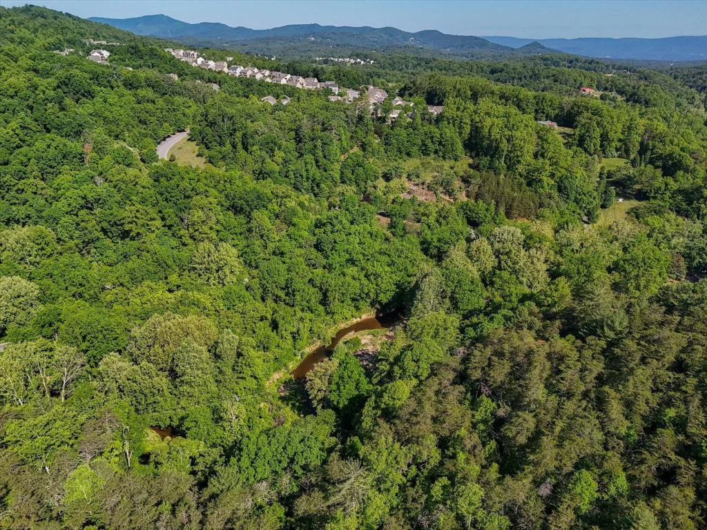
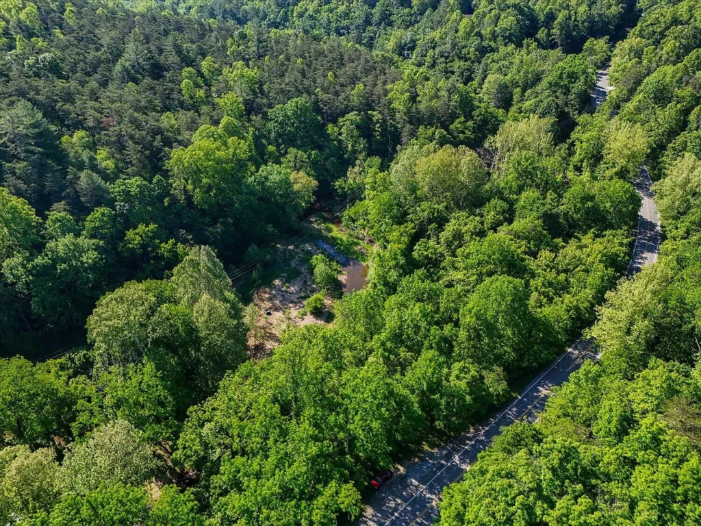
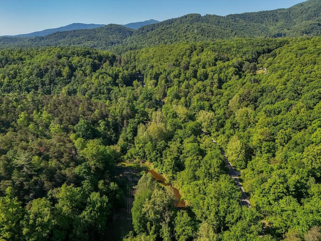
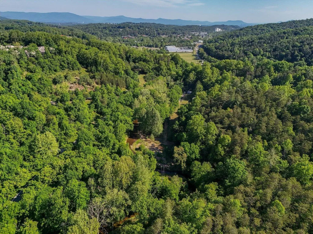
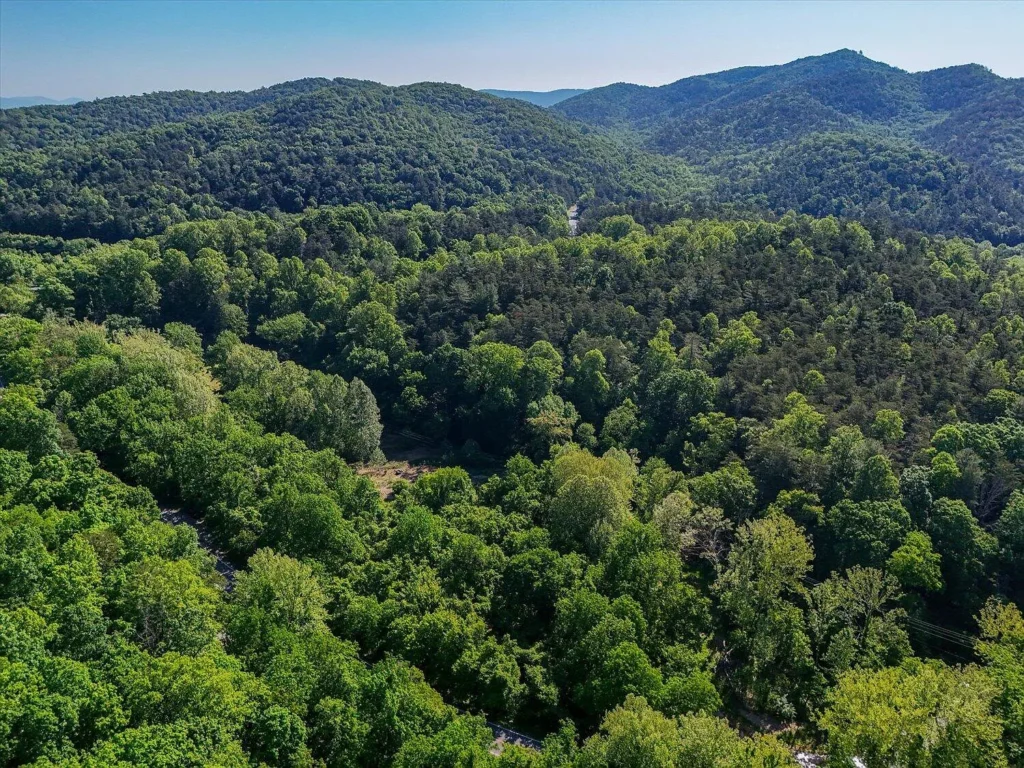
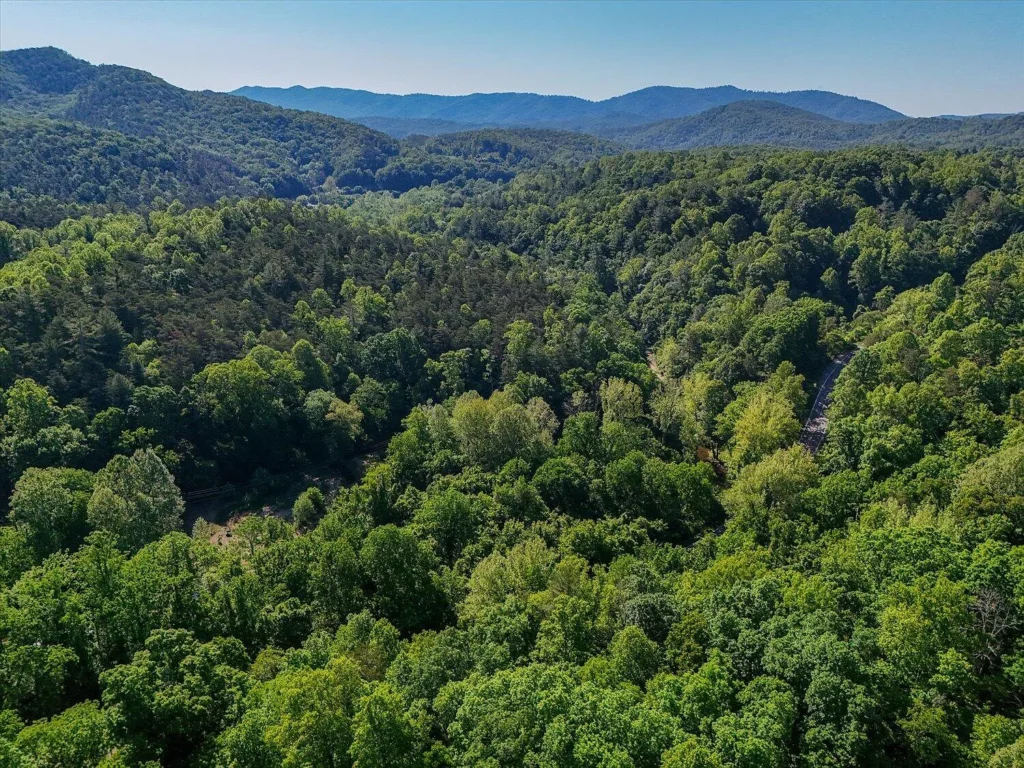
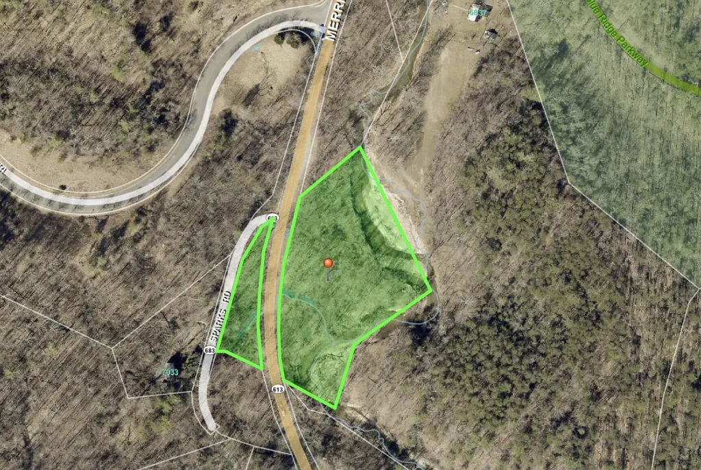
Offered at $25,000 ($5,882 per acre), this 4.25-acre unimproved parcel sits along Merriman Road in South Roanoke County (ZIP 24065). Featuring mature timber, mountain views, and an active stream, the land provides an entry-level purchase price within the desirable Penn Forest Elementary / Cave Spring High School district. However, the listing explicitly notes that the parcel lies within a designated FEMA floodplain, severely impacting residential development rights, septic permitting, and building feasibility.
Property Overview and Specification Summary
| Property Parameter | Listing Disclosures & Public Records |
|---|---|
| Street Address | 0 Merriman Rd, Boones Mill, VA 24065 |
| County / Region | Roanoke County (South Roanoke County Submarket) |
| Parcel Identification Number | 097.030136.000000 |
| Current Asking Price | $25,000 (Active status; ~171 cumulative days on market) |
| Total Land Footprint | 4.25 Acres (185,130 Square Feet) |
| Price Per Acre | $5,882.35 per acre |
| Price Per Square Foot of Land | $0.135 per sq. ft. |
| Topography & Features | Varied Terrain, Heavily Wooded, Active Stream, Mountain Views |
| Primary Environmental Constraint | Located in Designated FEMA Floodplain |
| Electrical Infrastructure | None Available at Parcel |
| Wastewater & Water | Septic Needed (Unpermitted); Private Well Needed |
| Zoning Classification | Residential / Rural (Roanoke County Zoning) |
| School District | Penn Forest Elem / Cave Spring Middle / Cave Spring High |
| Annual Property Taxes | $118.45 per year ($9.87 per month) |
| Homeowners Association (HOA) | None ($0.00 / month) |
| MLS Identifier | RVAR MLS #928080 |
Financial Metrics and Valuation Analysis
Evaluating raw land at $25,000 requires comparing purchase costs against fixed carrying overhead and adjacent South Roanoke County land benchmarks.
- Purchase Price: $25,000
- Price Per Acre: $25,000 ÷ 4.25 acres = $5,882.35 per acre
- Price Per Square Foot: $25,000 ÷ 185,130 sq. ft. = $0.135 per sq. ft.
- Comparative Land Basis: Dry, buildable residential lots in South Roanoke County typically trade between $15,000 and $45,000 per acre. An asking price of $5,882 per acre reflects a 60% to 80% discount, directly accounting for the severe encumbrance of the floodplain designation.
- Annual Holding Cost: Property taxes total $118.45 per year ($9.87 per month) with $0 HOA dues. The negligible tax burden allows an investor or recreational buyer to bank title indefinitely without holding-cost pressure.
Floodplain Realities and Permitting Constraints
The presence of a stream and designated FEMA floodplain status dictates what can—and cannot—be built on this acreage:
- Residential Building Prohibition / Elevation Requirements: Standard slab or crawlspace residential construction is generally prohibited or heavily restricted within mapped floodways. Constructing a dwelling requires a flood elevation certificate, engineered fill plans, and raised pier/pile foundations designed to withstand base flood elevations (BFE).
- Septic System Permitting Challenges: The Virginia Department of Health (VDH) generally denies conventional septic drainfield permits in 100-year floodplains due to high groundwater tables and risk of effluent contamination during flood events. Alternative engineered systems, if allowable, can exceed $25,000 to $40,000 in installation costs.
- Flood Insurance Mandates: Any financed structure erected in a Special Flood Hazard Area (SFHA) requires mandatory FEMA flood insurance, adding thousands in annual premium overhead.
Infrastructure & Utility Feasibility
- Electrical Access: The listing disclosures state “Electric: None Available” at the parcel boundary. Extending overhead or underground utility lines along Route 613 / Merriman Road requires written power company engineering estimates ($10 to $25 per linear foot).
- Water & Sewage: Requires a private drilled bedrock well and an engineered septic solution or holding tank, subject to VDH approval.
- Access & Road Frontage: Located off State Route 613 / Merriman Road. Physical driveway cuts require a VDOT (Virginia Department of Transportation) entrance permit.
Comparative Value Analysis: Subject Property vs. Nearby Merriman Rd Listings
| Property Option | Total Acreage | Asking Price | Price Per Acre | Floodplain Status | Primary Utility |
|---|---|---|---|---|---|
| 0 Merriman Rd (Subject) | 4.25 Acres | $25,000 | $5,882 / acre | 100% / Partial Floodplain | Recreational / Land Bank |
| 7385 Merriman Rd | 1.08 Acres | $20,000 | $18,519 / acre | Upland / Dry | Single Residential Lot |
| 7301 Merriman Rd | 6.74 Acres | $50,000 | $7,418 / acre | Partial Creek Boundary | Homesite / Agricultural |
Key Advantages vs. Primary Red Flags
Key Advantages
- Low Entry Acquisition Price: $25,000 provides a low-capital entry into 4.25 acres in South Roanoke County.
- Prime School District: Located in the sought-after Cave Spring school corridor.
- Ultra-Low Holding Overhead: Annual taxes of $118.45 per year ($9.87/month) with no HOA fees.
- Natural Recreational Assets: Features an active stream, mature forest canopy, and mountain views ideal for private green space, hunting, or camping.
Primary Red Flags
- Severe Building Restrictions: Floodplain overlay restricts standard residential home construction.
- Septic Permitting Obstacles: High likelihood of VDH septic permit denial due to seasonal high water tables.
- No Existing Utilities: Lacks power, well, or sewer connections at the street.
Target Buyer Profiles
| Buyer Category | Profile Characteristics | Fit Assessment |
|---|---|---|
| Recreational Buyers & Campers | Buyers seeking 4+ acres near Roanoke for weekend camping, fishing, or private greenspace. | Ideal Fit |
| Adjoining Landowners | Neighboring property owners seeking to expand privacy buffers or timber acreage at $5,882/acre. | Ideal Fit |
| Long-Term Speculators | Investors looking to bank raw land in Roanoke County with $9.87/month tax overhead. | Ideal Fit |
| Turnkey Homebuilders | Buyers seeking an immediate buildable lot for a primary single-family residence. | Unfavorable Fit |
Essential Buyer Due Diligence Checklist
- Overlay FEMA Flood Maps: Cross-reference parcel boundary lines with the FEMA Flood Insurance Rate Map (FIRM) to determine exact acreage percentages inside the 100-year floodway versus non-flood fringe areas.
- Consult Roanoke County Planning & Zoning: Meet with county zoning administrators to confirm building setbacks, fill restrictions, and allowable structures (e.g., pole barns, storage, elevated platforms).
- Request VDH Septic Evaluation: Hire a Licensed Onsite Soil Evaluator (JOSE) to conduct soil borings and determine if any portion of the 4.25 acres can support a legal drainfield.
- Obtain AEP Power Extension Quote: Contact Appalachian Power (AEP) to calculate service extension costs from the nearest transformer.
- Verify VDOT Ingress/Egress: Confirm sightline distances along Route 613 to secure a commercial or residential driveway entrance permit.
0 Merriman Road presents an affordable land footprint in South Roanoke County. Priced at $25,000 ($5,882 per acre), its primary strengths lie in its location, natural stream setting, and ultra-low $9.87/month tax burden. However, the floodplain designation represents a major obstacle for conventional residential development. For recreational buyers, anglers, or long-term land-banking investors who do not require a standard single-family home build, this listing offers a low-cost acreage footprint.
Listed on Zillow