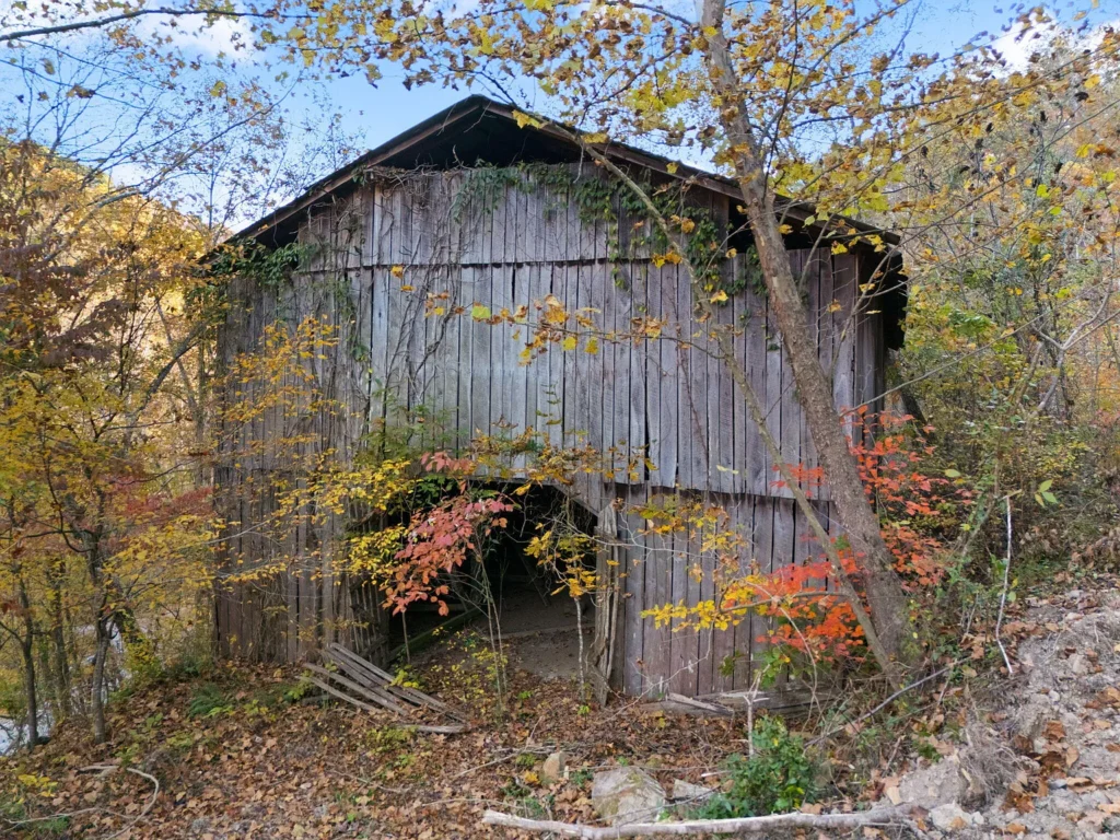
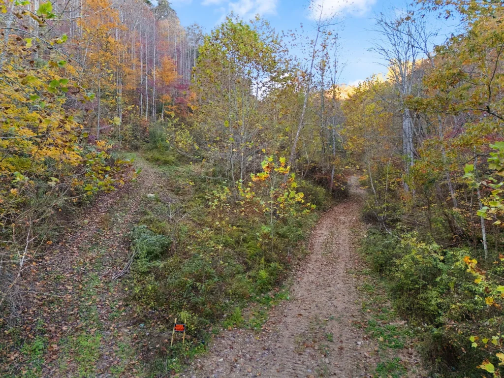
Priced at $189,500—which breaks down to an advantageous $1,895.00 per acre—this 100-acre unrestricted tract located at 9992 South Ky #11 in Manchester, Kentucky (ZIP 40962, Clay County) represents a versatile mountain and valley land asset in the Appalachian foothills. Listed on April 22, 2026, the property features a balance of flat, buildable bottomland along state highway frontage and private mountain slopes. Equipped with key infrastructure head starts—including an existing wooden barn, installed public water meters, set utility poles, and roadside natural gas and fiber internet—this parcel is primed for immediate residential, agricultural, or recreational development.
Featuring a year-round valley stream, two seasonal waterfalls, mature hardwood timber, and partial conveyed mineral rights, 9992 South Ky #11 offers strong fundamental value. Whether developed as an off-grid homestead, a private hunting preserve, an eco-tourism cabin retreat, or a long-term land-banking asset, the property delivers an optimal combination of accessibility, utility readiness, and natural beauty.
Property Specifications & Utility Overview
Evaluating public registry records, Clay County Property Valuation Administrator (PVA) maps (Parcel ID: 0570000025.00), and official listing disclosures establishes the baseline parameters.
| Property Parameter | Listing Disclosures & County Public Data Baseline |
| Street Address | 9992 South Ky #11, Manchester, KY 40962 |
| County / Region | Clay County / Eastern Kentucky Coalfield (Cumberland Plateau) |
| Parcel Identification Number | 0570000025.00 |
| Current List Price | $189,500 (Listed April 22, 2026) |
| Total Deeded Footprint | 100.00 Acres m/l (4,356,000 Square Feet; PVA Estimate) |
| Price Per Acre | $1,895.00 per acre |
| Price Per Square Foot | $0.0435 per sq. ft. |
| Zoning Classification | Unrestricted / No Zoning (Clay County Jurisdiction) |
| Existing Outbuildings | Rustic Wooden Barn & Equipment Storage Frame |
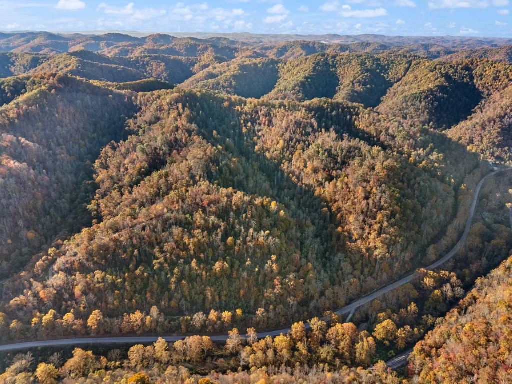
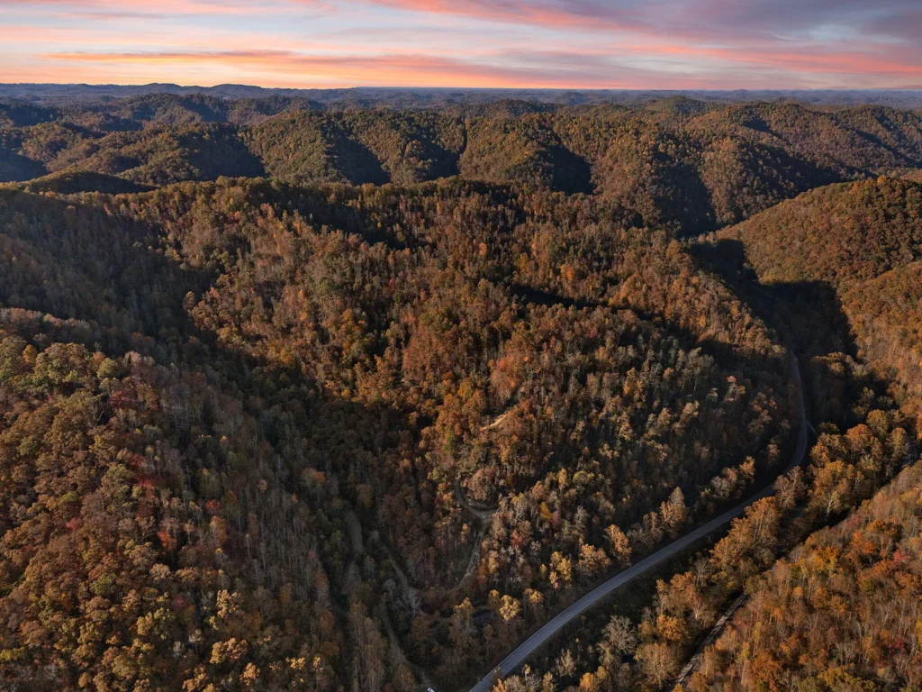
| Topography Profile | Level Highway Bottomland, Rolling Valleys, Steep Mountain Slopes |
| Hydrology & Water Features | Year-Round Valley Stream, 2 Seasonal Rock Waterfalls |
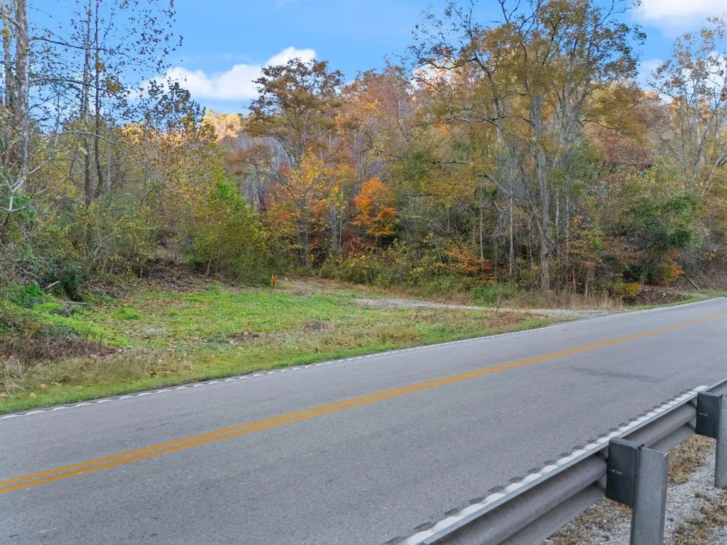
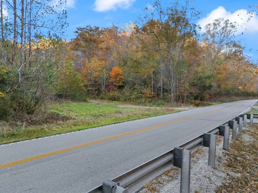
| Road Frontage & Access | Paved State Highway Frontage (South KY Highway 11) |
| On-Site Utility Hardware | Installed Public Water Meters, Set Utility Pole Drops |
| Roadside Utility Connections | Natural Gas Line, High-Speed Cable/Fiber, Phone Lines |
| Wastewater Sanitation | Unimproved (Requires Private Septic System) |
| Mineral Rights Status | Partial Mineral Rights Convey (Buyer to verify deeded share) |
| Contiguous Land Options | Bordering 32 AC (MLS# 26008614) & 33 AC (MLS# 26008686) |
| Annual Property Taxes | Projected ~$400.00 – $650.00 per year (~$33.00 – $54.00 per month) |
| HOA / Association Dues | None ($0.00 / month) |
Unbundled Valuation Breakdown
Analyzing the purchase price across individual land types and physical improvements provides a clear perspective on the property’s financial structure.
| Asset Component | Estimated Value Allocation | Valuation Detail & Calculation Basis |
| Base Mountain Timberland (85 Acres) | $110,500 | Assigned at $1,300/acre baseline for steep rural mountain slopes |
| Prime Highway Bottomland (15 Acres) | $45,000 | Valued at $3,000/acre for flat, buildable state highway frontage |
| Utility Infrastructure (Water & Power) | $14,000 | Implied value of set water meters and installed power drops |
| Existing Wooden Barn & Cleared Pad | $12,000 | Replacement value of the timber-frame barn and cleared site work |
| Conveyed Mineral Rights Share | $8,000 | Capitalized value of partial mineral rights conveying with the deed |
| TOTAL ESTIMATED ASSET VALUE | $189,500 | Matches asking purchase price ($1,895.00 / acre) |
Low Tax Carrying Overhead
Holding 100 acres in Clay County requires minimal ongoing maintenance costs:
- Estimated Annual Property Taxes: ~$400.00 to $650.00 per year
- Monthly Tax Overhead: ~$33.33 to $54.17 per month
- HOA / Landowner Dues: $0.00 / month
- Total Holding Cost Basis: Under $55.00 per month, making long-term land-banking or phased development highly cost-effective.
Topography & Zonal Analysis
Topographic surveys and site disclosures outline four distinct physical zones across the 100-acre footprint.
| Topographic Zone | Elevation & Features | Key Characteristics & Land Utility |
| Highway Frontage Corridor | Paved Highway Level | Direct frontage along South KY Hwy 11; primary utility access point |
| Valley Bottomland & Basin | Flat-to-Rolling Benches | Prime building pads; houses the wooden barn and main stream |
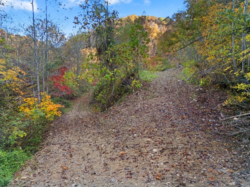
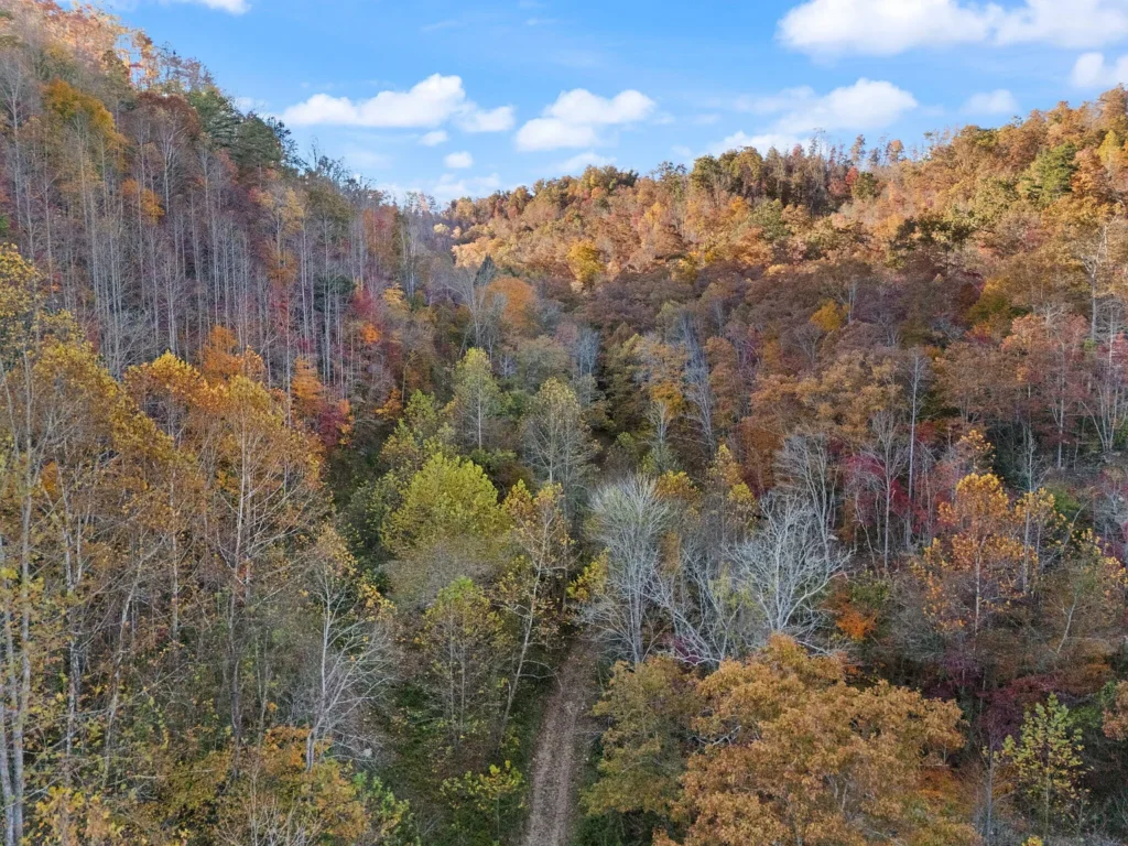
| Timbered Mountain Slopes | Moderate-to-Steep Slopes | Dense oak/hickory timber; 2 seasonal waterfalls; UTV trails |
| Upper Mountain Ridges | High Elevation Vistas | Scenic overlooks; wildlife bedding areas; off-grid campsites |
Projected Development & Capital Expenditure Budget
Developing 9992 South Ky #11 into a fully serviced homestead or multi-cabin retreat requires planned infrastructure investments:
| Site Development Component | Low-End Estimate (DIY / Local) | High-End Estimate (Contractor) | Technical Scope & System Details |
| Boundary Survey & Corner Marking | $2,500 | $4,500 | Essential to establish exact legal lines over PVA estimates |
| Driveway Expansion & Culverts | $3,500 | $8,500 | Extend gravel drive off KY-11 into valley building pad |
| Public Water Line Extension | $1,500 | $3,500 | Run poly line from installed water meters to cabin site |
| Electrical Service Drop & Panel | $2,200 | $5,000 | Install meter base on existing utility pole & set panel |
| Private Septic System (OWTS) | $7,500 | $13,500 | Soil perc test, tank installation, & leach field design |
| Natural Gas Line Tap | $1,500 | $3,800 | Connect to roadside natural gas main for domestic heating |
| Barn Structural Cleanup/Repair | $2,000 | $6,000 | Reinforce posts, replace boards, & clean storage bays |
| Internal Trail Grading (UTV) | $2,500 | $5,500 | Re-grade mountain trails to upper ridge overlooks |
| TOTAL PROJECTED CAPEX | $23,200 | $50,300 | Estimated total cost for complete site utility integration |
Regional Comparative Market Analysis (CMA)
Comparing 9992 South Ky #11 against active and sold acreage listings in Clay and surrounding counties highlights its competitive price basis:
| Property Location & Details | Acreage | List Price | Price / Acre | Key Features & Infrastructure |
| 9992 South Ky #11, Manchester (Subject) | 100.00 AC | $189,500 | $1,895.00 | Barn; Water meters & power pole; Hwy 11 frontage; Stream |
| South Ky Hwy 11 (Tract A), Manchester, KY | 32.00 AC | $51,200 | $1,600.00 | Adjoining parcel; Raw timberland; Hwy frontage |
| South Ky Hwy 11 (Tract B), Manchester, KY | 33.00 AC | $59,235 | $1,795.00 | Adjoining parcel; Mountain terrain; Road access |
| S Highway 11 Tract, Manchester, KY | 213.00 AC | $160,000 | $751.17 | Very steep mountain terrain; Landlocked sections; No utilities |
| Crawford Isom Rd, Manchester, KY | 113.00 AC | $240,000 | $2,123.89 | Paved frontage; Mixed pasture and woodland; No barn |
| Midnight Stable Rd, Manchester, KY | 74.05 AC | $100,000 | $1,350.44 | Remote off-grid parcel; Steep topography; Rough gravel access |
Strategic Advantages vs. Critical Risk Factors
Key Advantages (Pros)
- Attractive Sub-$2,000/Acre Basis: Listed at $1,895/acre, offering an affordable entry price for 100 contiguous acres.
- Utilities Already Installed: Features set water meters and utility poles on site, with gas and fiber available along the road.
- Paved Highway Frontage: Direct access off South KY Highway 11 ensures easy year-round entry.
- Multi-Elevation Layout: Combines flat, buildable valley bottomland with private mountain ridges.
- Natural Water Features: Includes a year-round valley stream and two seasonal waterfalls.
- Existing Storage Barn: Wooden barn structure provides immediate equipment storage.
- Unrestricted Zoning: No municipal zoning regulations, allowing complete freedom for land use.
- Assemblage Potential: Option to acquire neighboring 32 AC and 33 AC tracts to build a 165-acre compound.
Critical Risk Factors (Cons)
- Survey Verification Needed: Listing relies on PVA tax map estimates; a licensed boundary survey is necessary to pin exact corners.
- Steep Mountain Topography: High-elevation sections are steep, restricting primary home building mainly to the lower bottomland and upper ridge benches.
- Septic System Required: Wastewater requires an engineered septic tank and soil percolation approval.
- Partial Mineral Rights: Mineral rights convey only on portions of the parcel, requiring deed verification during title search.
Essential Buyer Due Diligence Roadmap
- Order Boundary Survey: Retain a licensed Kentucky surveyor to establish exact property lines, flag corner pins, and calculate total acreage.
- Conduct Mineral Rights Audit: Work with a local real estate attorney to verify the precise deeded percentage of conveying mineral rights.
- Perform Soil Percolation Test: Schedule a certified soil test in the lower bottomland area to confirm septic drain field suitability.
- Verify Utility Meter Status: Confirm active service status with the local public water district and electric cooperative for on-site hookups.
- Evaluate Adjoining Parcels: If interested in expanding the estate, review combined purchase terms for MLS# 26008614 (32 AC) and MLS# 26008686 (33 AC).
Listed on Zillow